Romania, Transylvania and Transfagarash
- TitleColor: #ffffff
- DateColor: #000000
- TitleOnImg: Yes
- SizeFont: 44
Duration: 4 days
Approximate distance: 1250 km
Overnight stays abroad: 3 nights
Countries covered by the route: Romania only
Itinerary
Merry Cemetery – Barsana Monastery – Forest Railway – Sighisoara – Covered Staircase – Brasov – Bran Castle – Transfagarasan – Sibiu – Corvin Castle – Alba Iulia Citadel – Turda Salt Mine – Cluj-Napoca
Route on Google Maps: https://goo.gl/maps/tWANNE51NN62CXcL6
Language
A large percentage of the population understands and speaks English. There were no language issues. At the top of the Transfagarasan pass, we met cyclists from Zaporizhia.
Currency
In Romania, the currency is the Romanian Leu (currency code RON). It's easiest to have a bank card with you. There were no problems with card payments. We traveled the entire route without local currency, using both cards and euros. You can exchange a small amount of money into cash in cities. If you have leftover cash at the end of the route, you can use it for refueling to avoid currency exchange losses.
Border Crossing
The nearest border crossing to the first point of the route is the Solotvyno-Sighetu Marmatiei checkpoint in the Zakarpattia region. The checkpoint is small, and the border crossing takes place over an old bridge with wooden beams and a wooden deck. Romanian border guards may ask to show the cash you have with you.
Border Crossings with Romania:
- Dyakove-Khalmeyu (Zakarpattia region)
- Solotvyno-Sighetu Marmatiei (Zakarpattia region)
- Porubne-Siret (Chernivtsi region)
- Renі – Moldova – Romania (Odesa region) – it is very far from this border crossing to the first point of the route, so we recommend adjusting the route when entering from this side.
You can view the border crossing points on the map and their congestion on the State Border Guard Service of Ukraine website:
https://dpsu.gov.ua/ua/map
Toll Roads
In Romania, tolls are required for the roads. You need to buy an electronic vignette, which can be done at Rompetrol, Petrom, and OMV gas stations or at post offices. You can also buy it online on the website: https://www.roviniete.ro/ru/
The vignette for 7 days for a passenger car will cost € 3.
For more information about road tolls, mandatory equipment in the car, and other nuances regarding travel through the country, read the article about Romania.
Fuel Prices in Romania
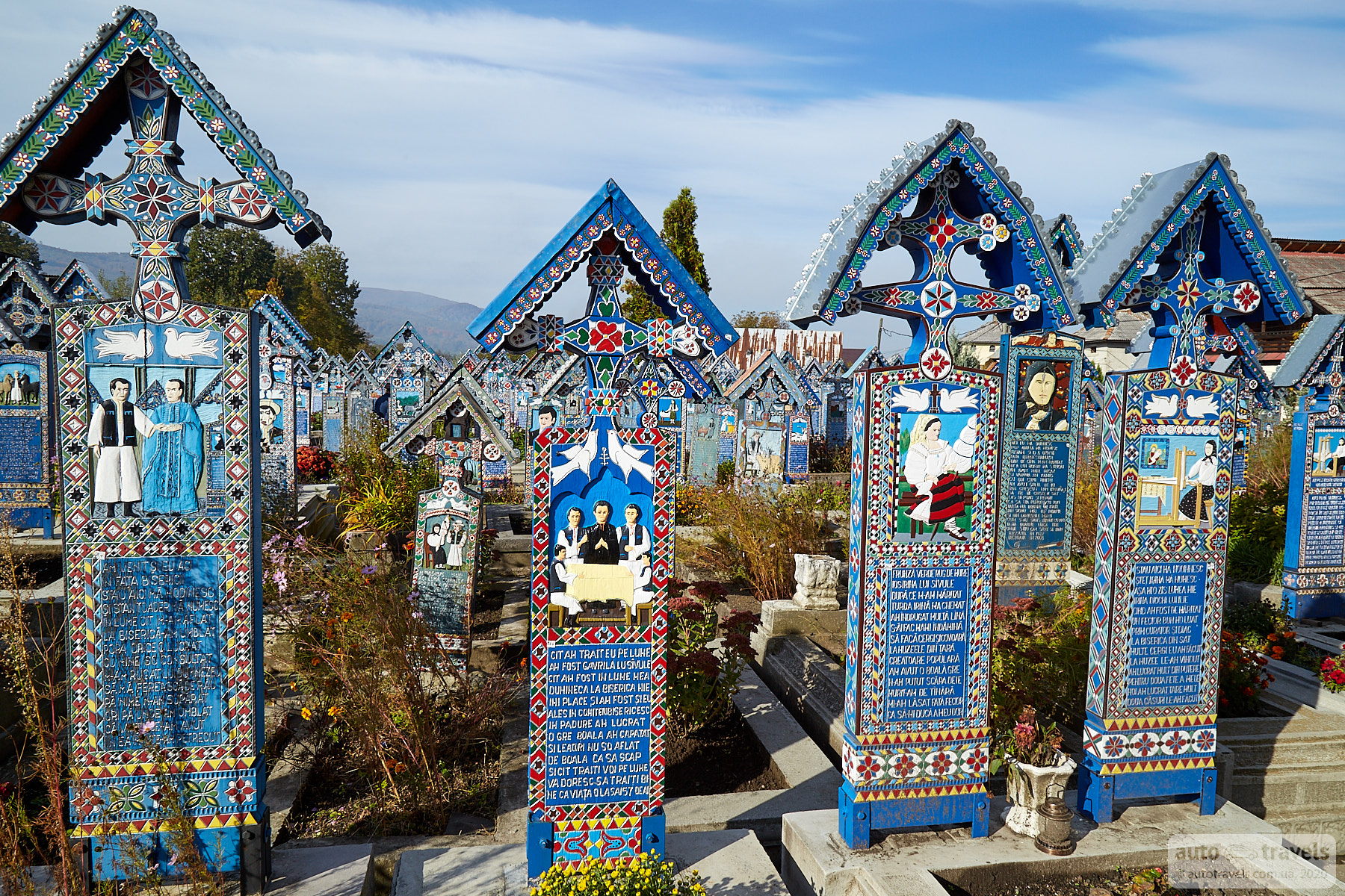
Merry Cemetery – Cimitirul Vesel
Coordinates on Google Maps: https://goo.gl/maps/TQ4k3FBWKDFLSEgj7
The cemetery with colorful wooden tombstones, each inscribed with witty texts or verses about the person's life or the reasons for their death. A popular tourist destination. Interesting to visit at least once.

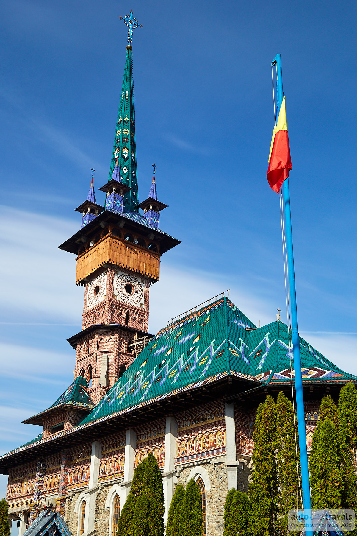
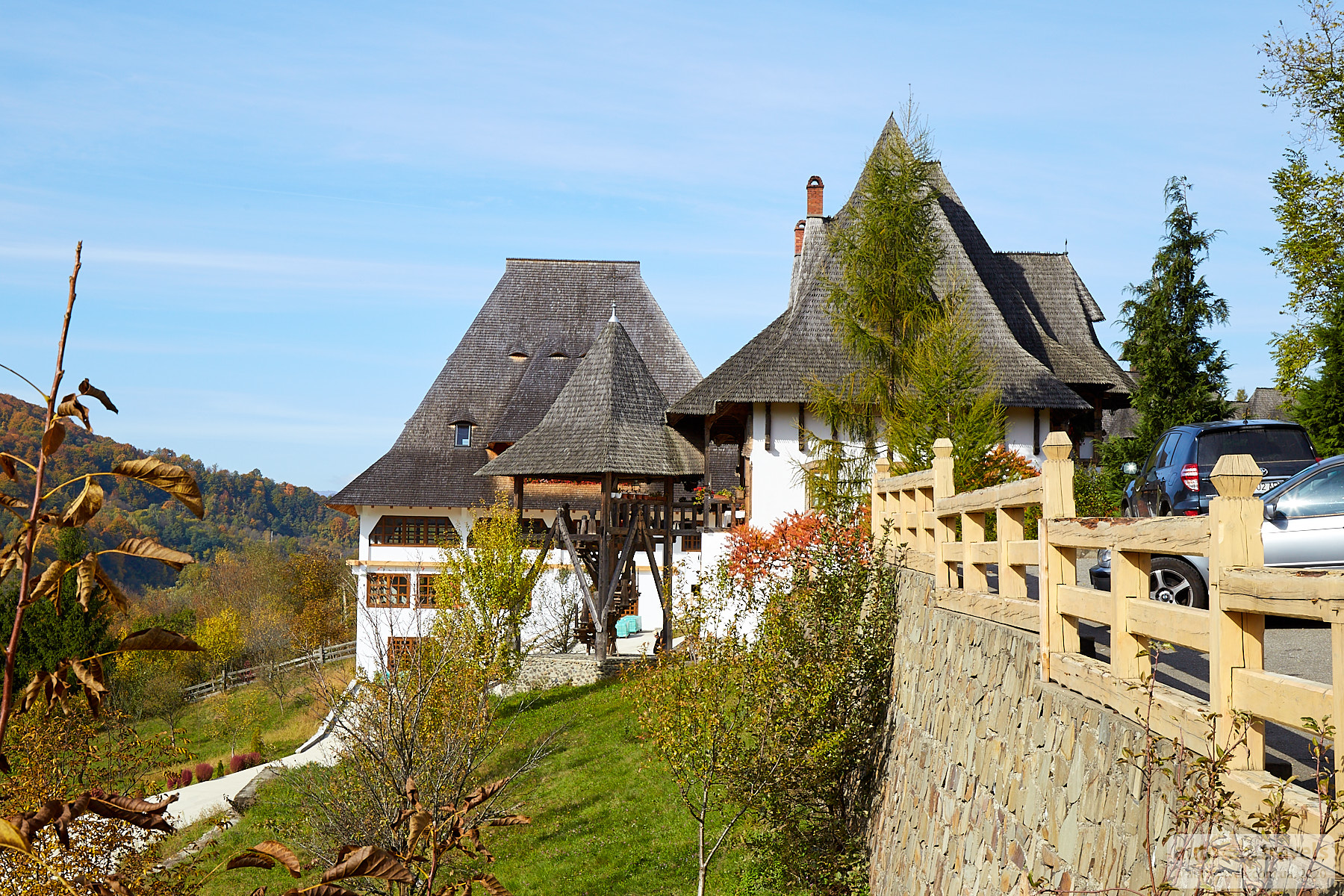
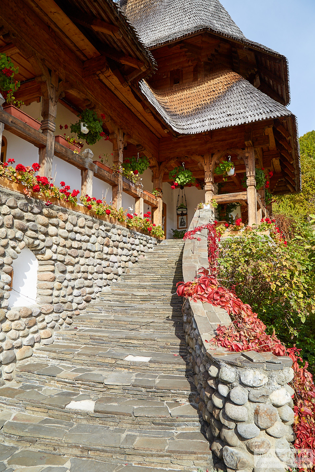
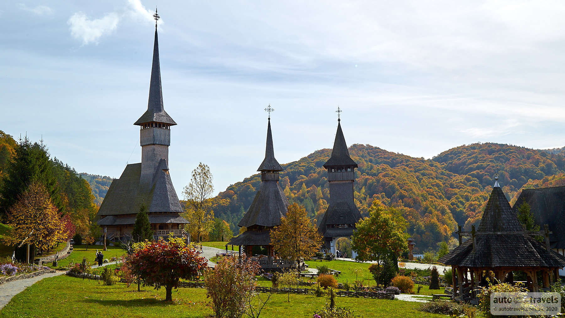
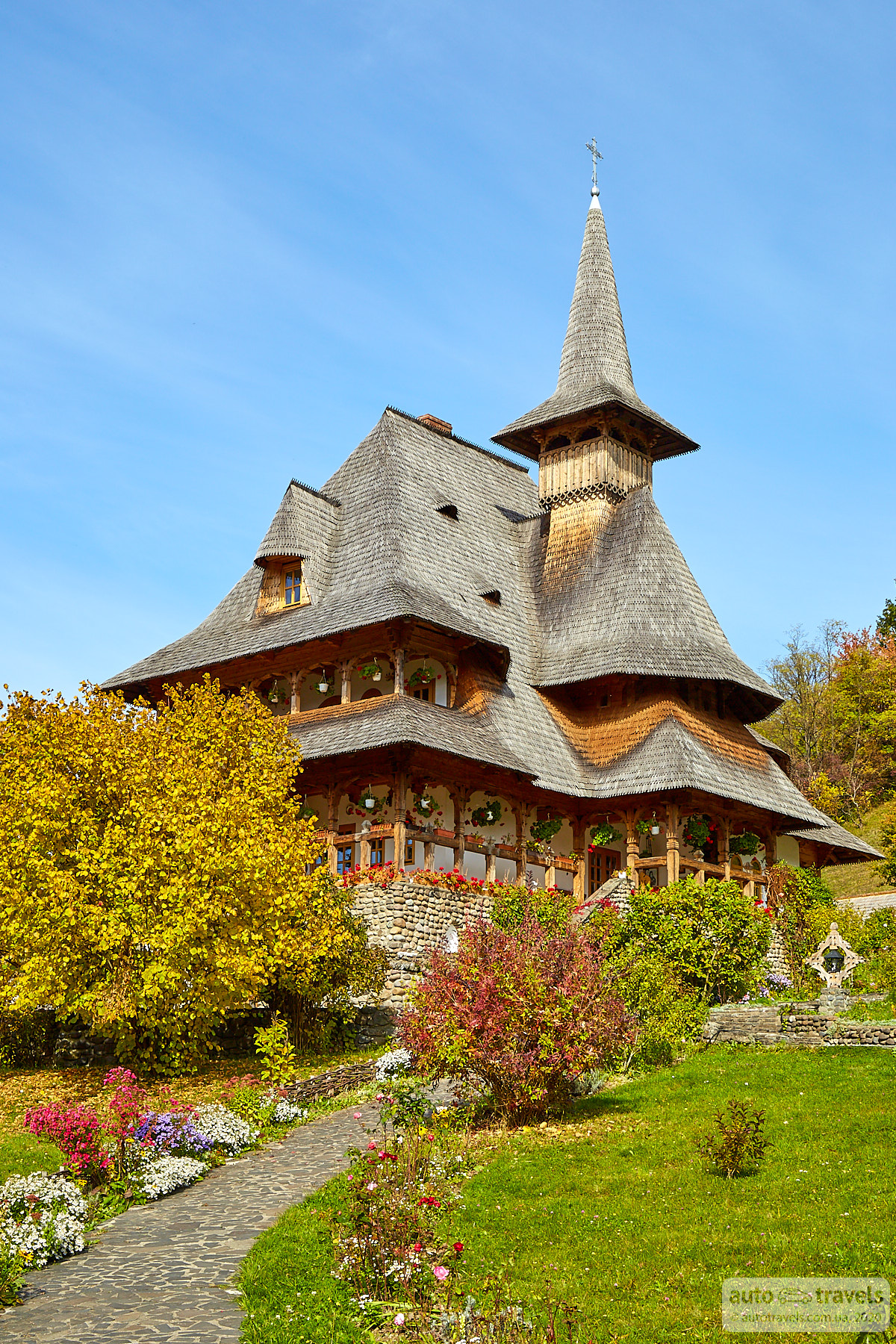
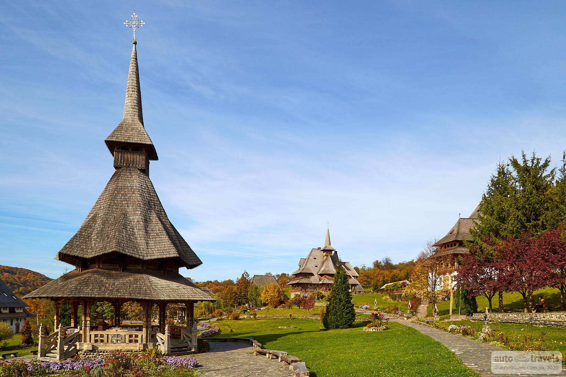
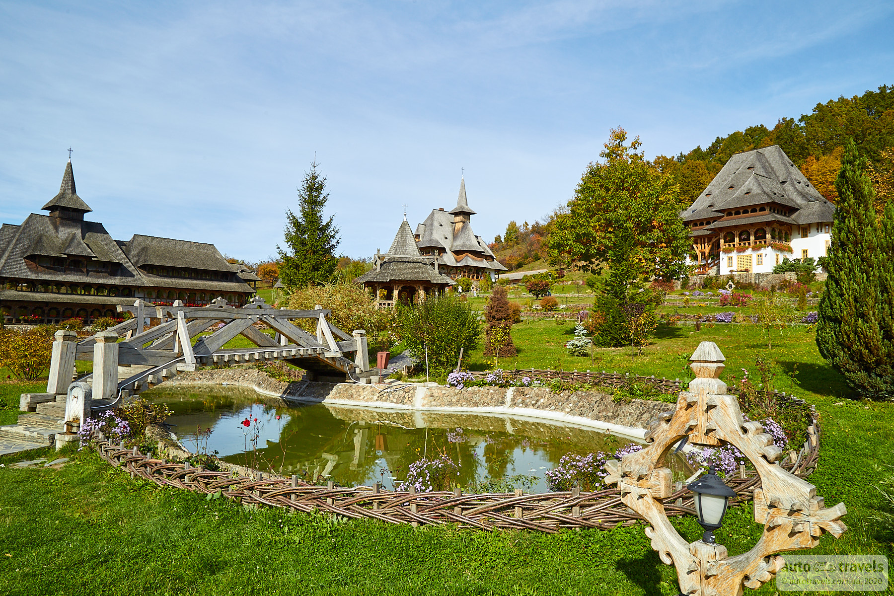
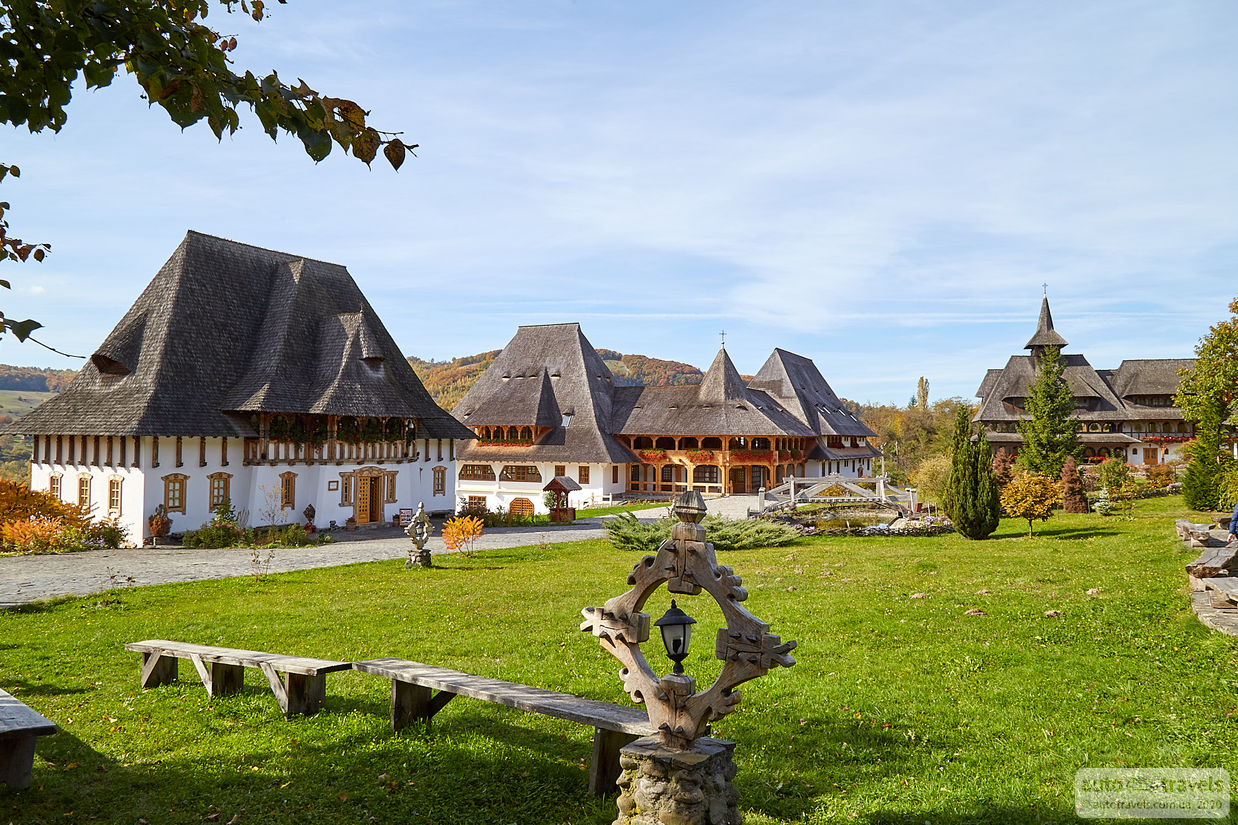
Bârsana Monastery – Mănăstirea Bârsana
Coordinates on Google Maps: https://goo.gl/maps/48K79KULAuptgBNPA
Official website: http://manastireabarsana.ro
A monastery built of wood, with the tallest structure being a 57-meter-high church. A very beautiful and picturesque place. You can stroll around as in a small park with lots of greenery and flowers.


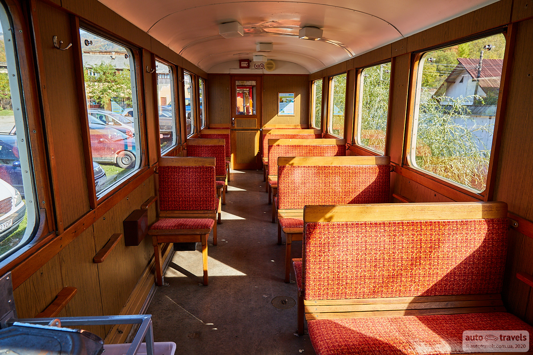
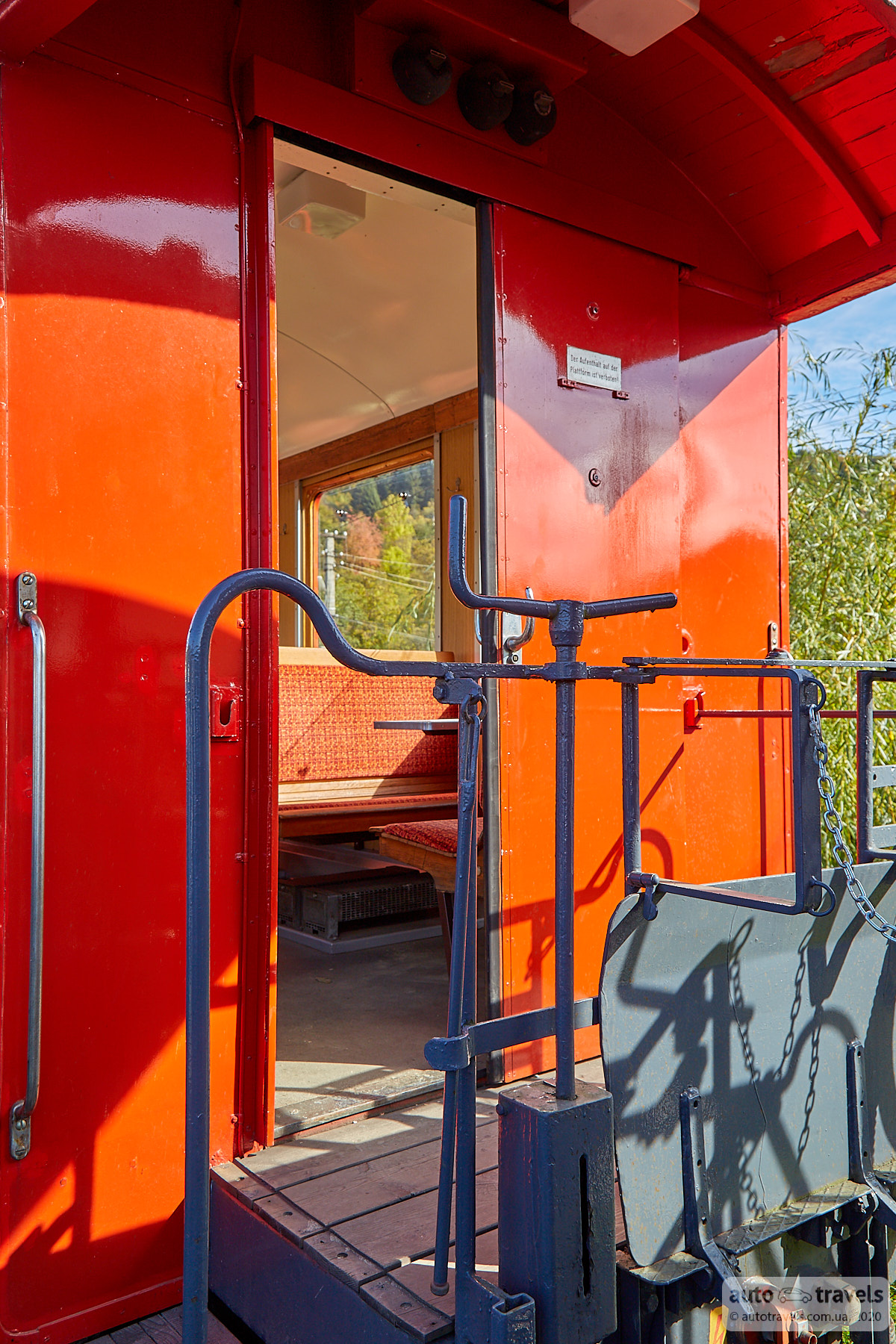
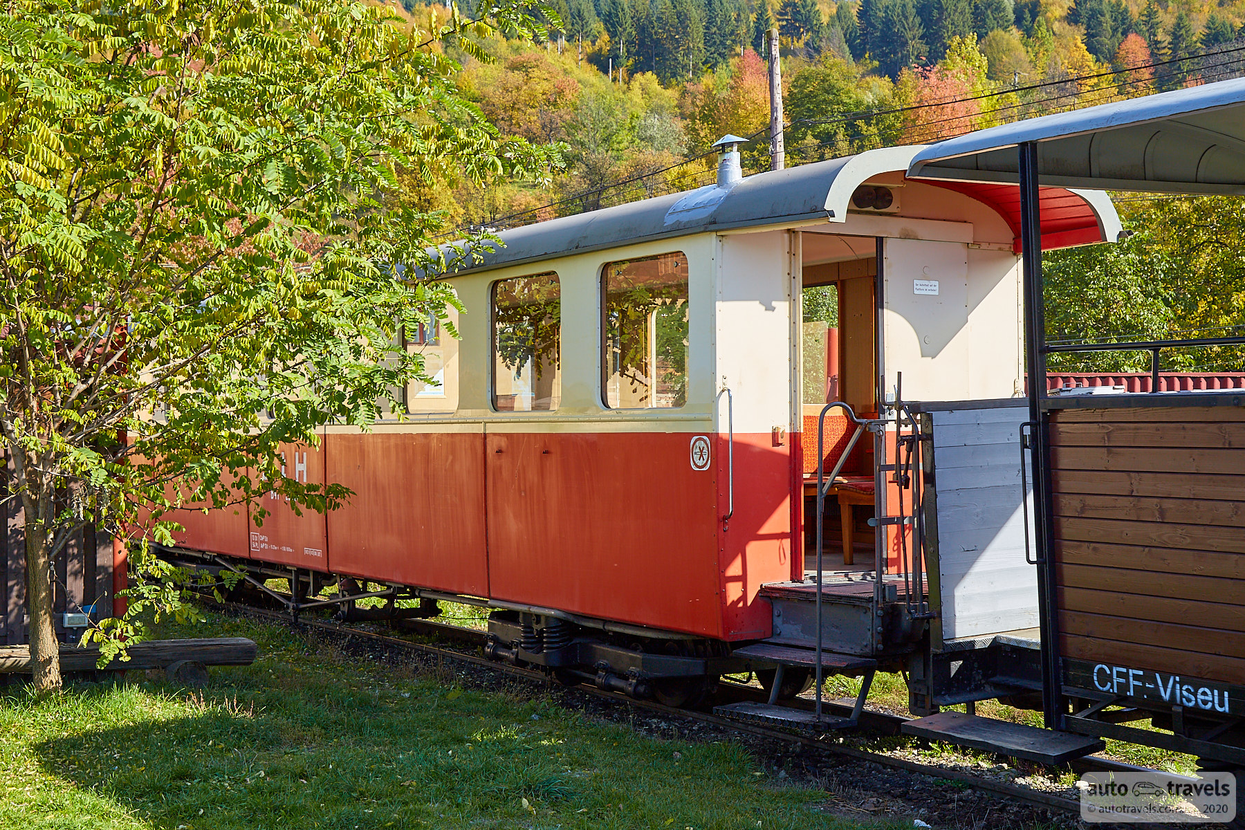
Viseu de Sus Forest Railway (Gara Mocăniței Viseu de Sus - Gara Căii Ferate Forestiere)
Coordinates on Google Maps: https://g.page/mocanitamaramures?share
Official website: https://www.cffviseu.com/en/home/
A narrow-gauge forest railway with a length of 46 km. We arrived just before 3:00 PM and only witnessed the arrival of the train. If you want to ride the train, you need to come before 9:00 AM. All details are available on the official website. I can't say if it's interesting because we didn't get a chance to ride.


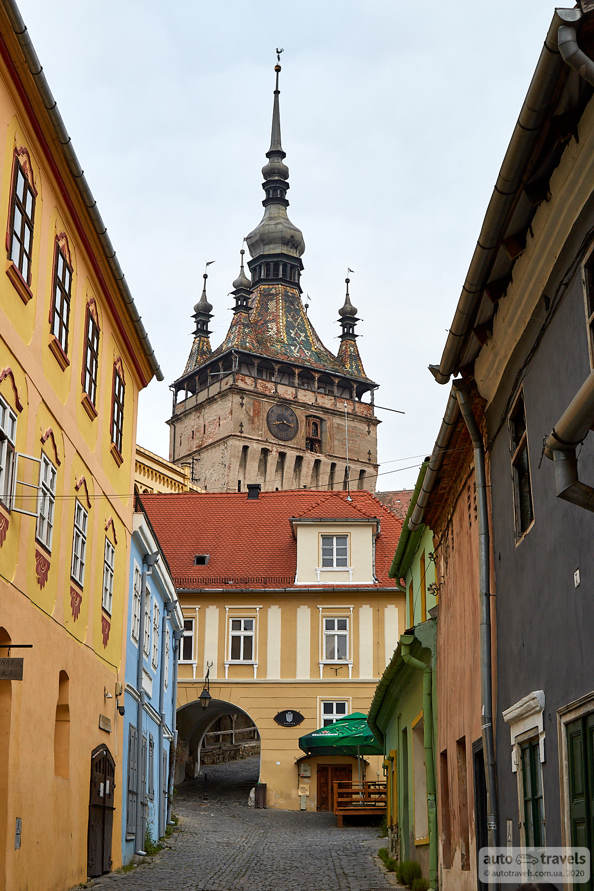
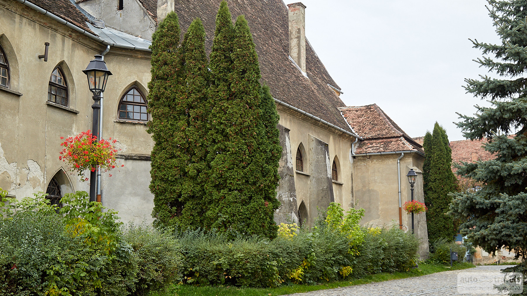
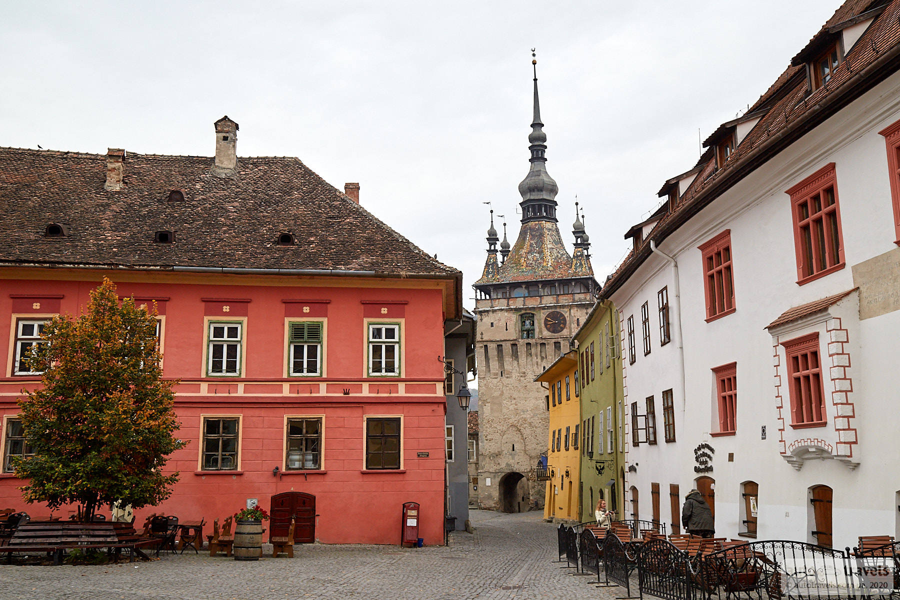
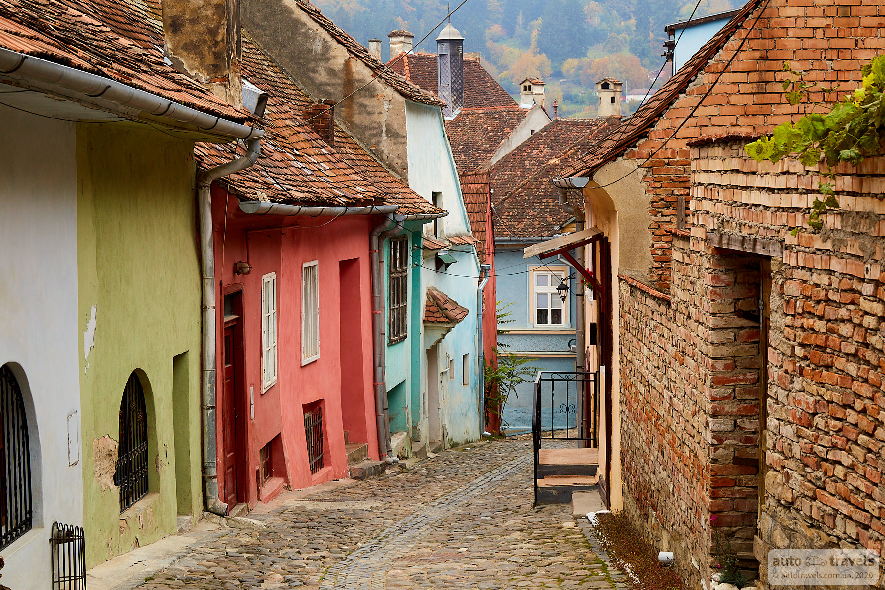
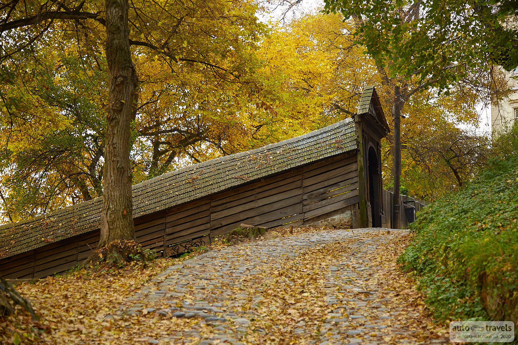
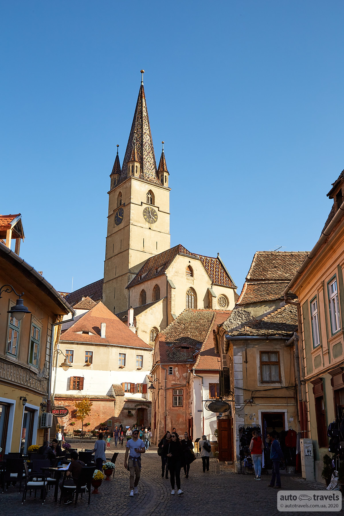
Sighișoara
A quiet and peaceful Romanian town. In the evening, you'll find people mainly in pubs; the streets are almost empty. We stayed overnight here and explored the pleasant old center and the unusual Covered Stairs in the morning light. The old town has a charming atmosphere.
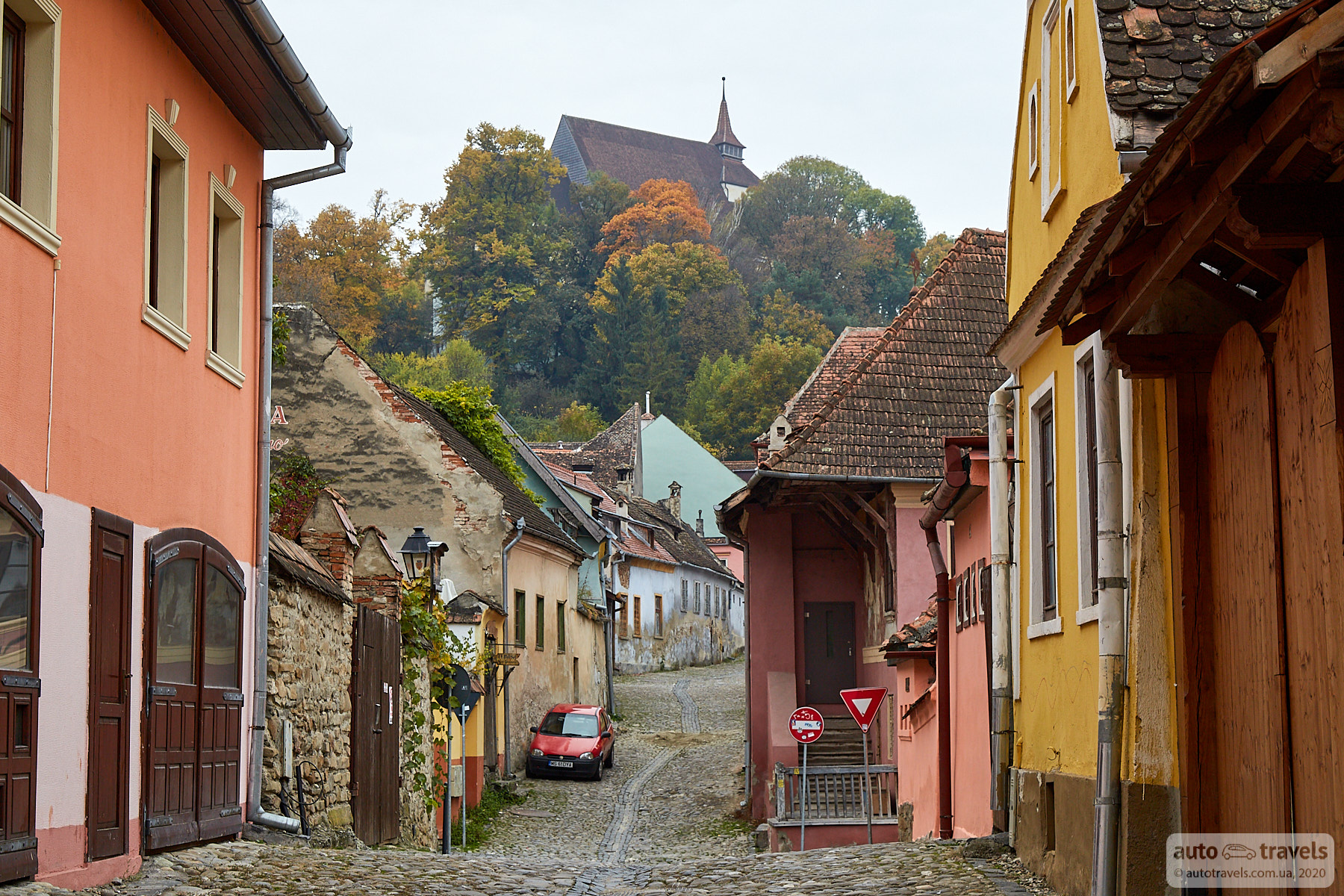
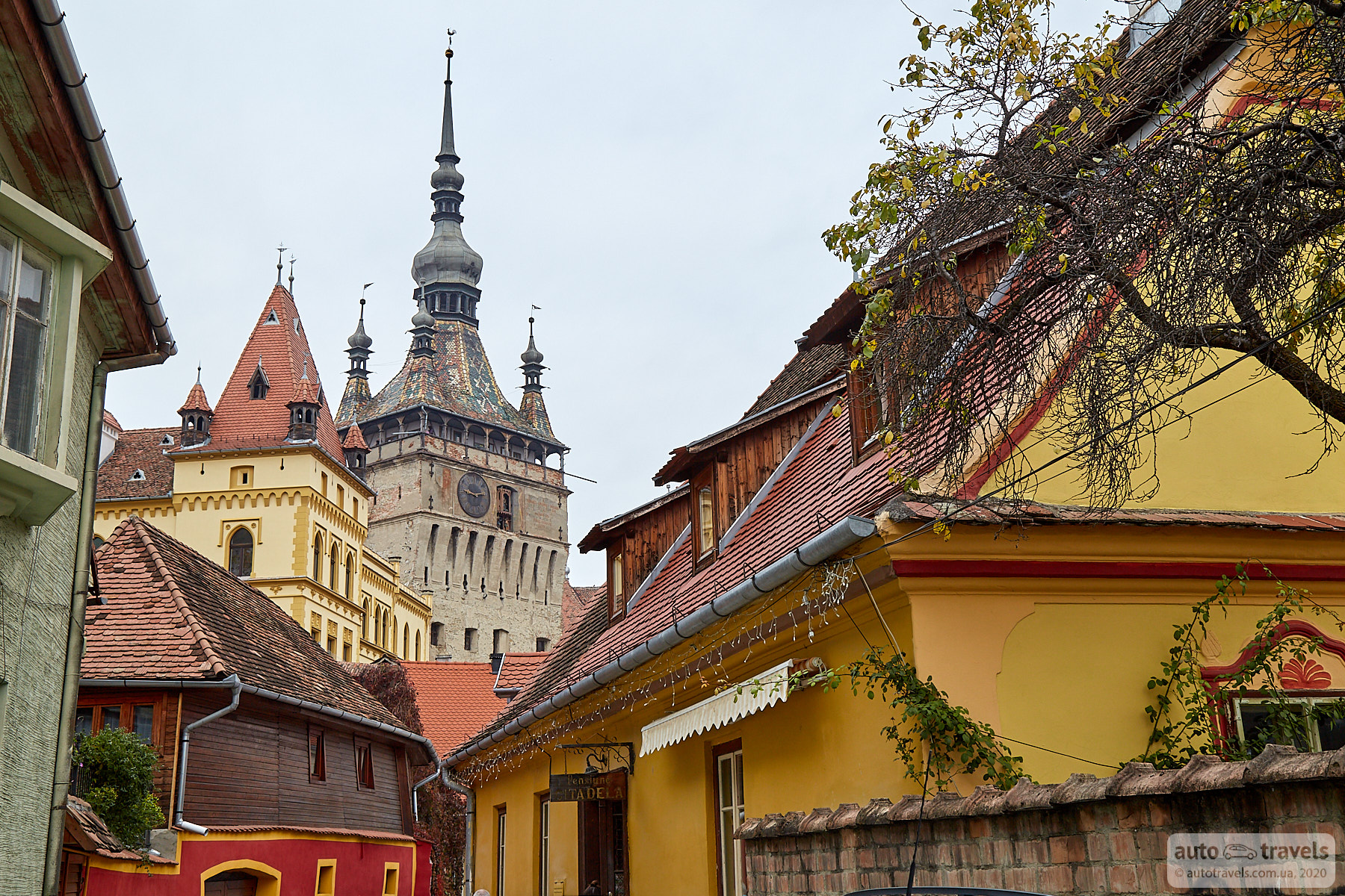
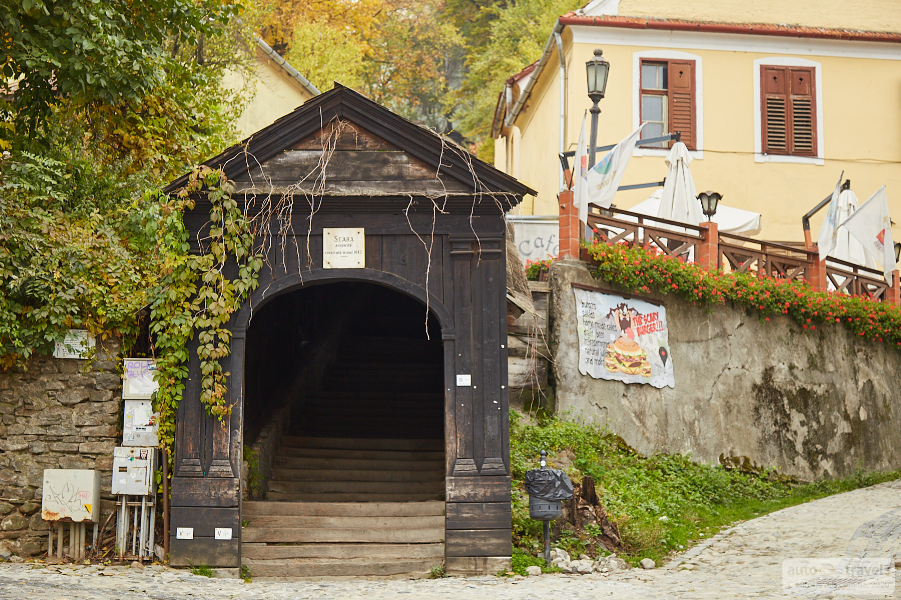
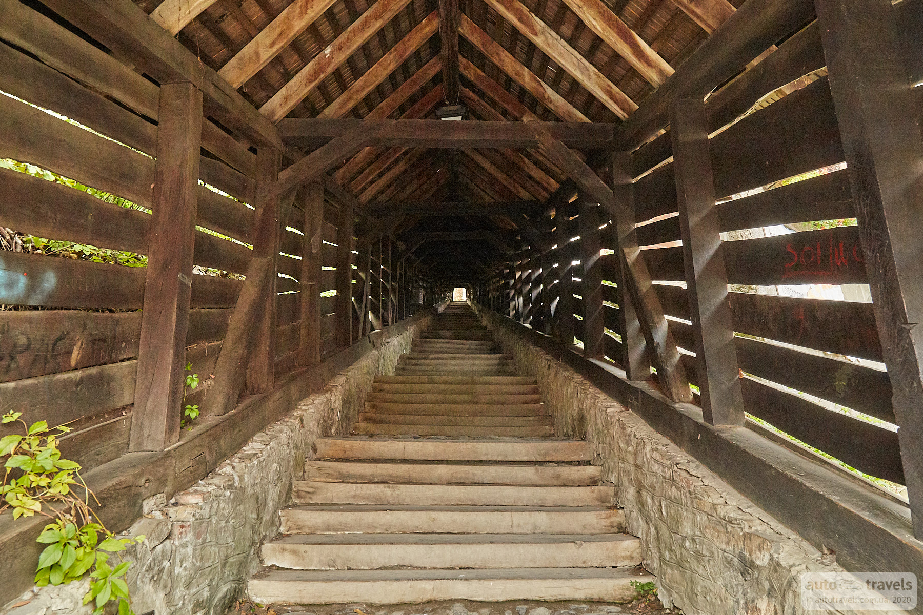
Covered Stairs – Scara acoperită (Sighișoara)
Coordinates on Google Maps: https://goo.gl/maps/MV2rbHeJS7kVZ7Jo7
These stairs lead to the church from the town center. There is also a bypass road nearby; I recommend trying both the stairs and the road.
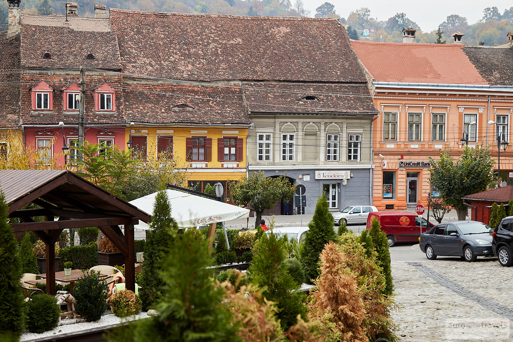
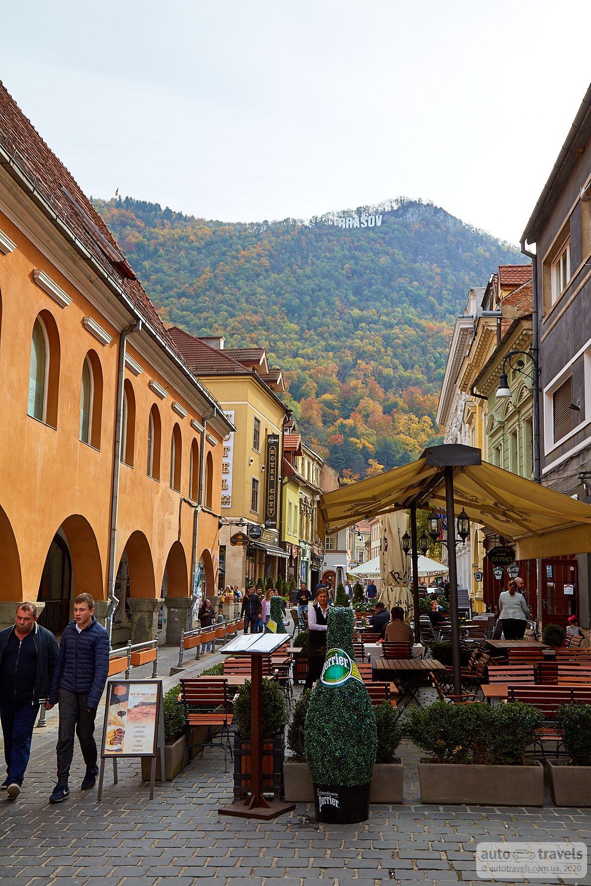
Brașov
It feels like a touristy town with many restaurants. During the day, the central square is bustling with people. You can have lunch here, and if needed, you can buy supplies at local shops or the shopping center. The city is interesting because it is located right under the mountain, and the streets from the central square lead straight into the mountain, where a large sign "Brașov" stands, reminiscent of the Hollywood sign. It is the nearest city to Bran Castle, famously known as Dracula's Castle.


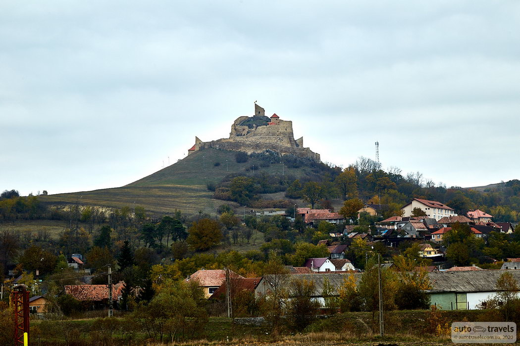
Râșnov Citadel – Cetatea Râșnov
Coordinates on Google Maps: https://goo.gl/maps/5moWpJZDNbNQ6558A
We managed to catch a glimpse of the citadel from the car window. Unfortunately, we didn't have time to visit. If your trip is for 4 days or more, you might have time to explore this place.
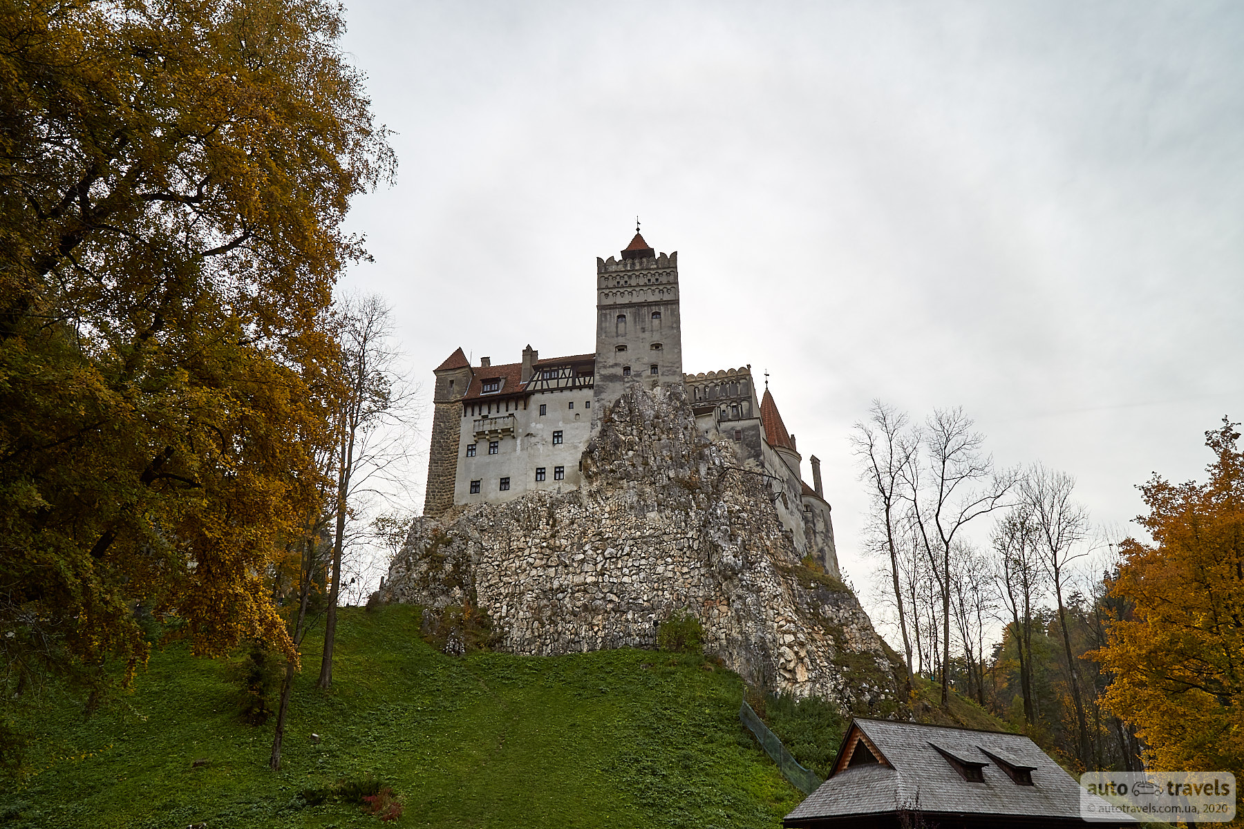
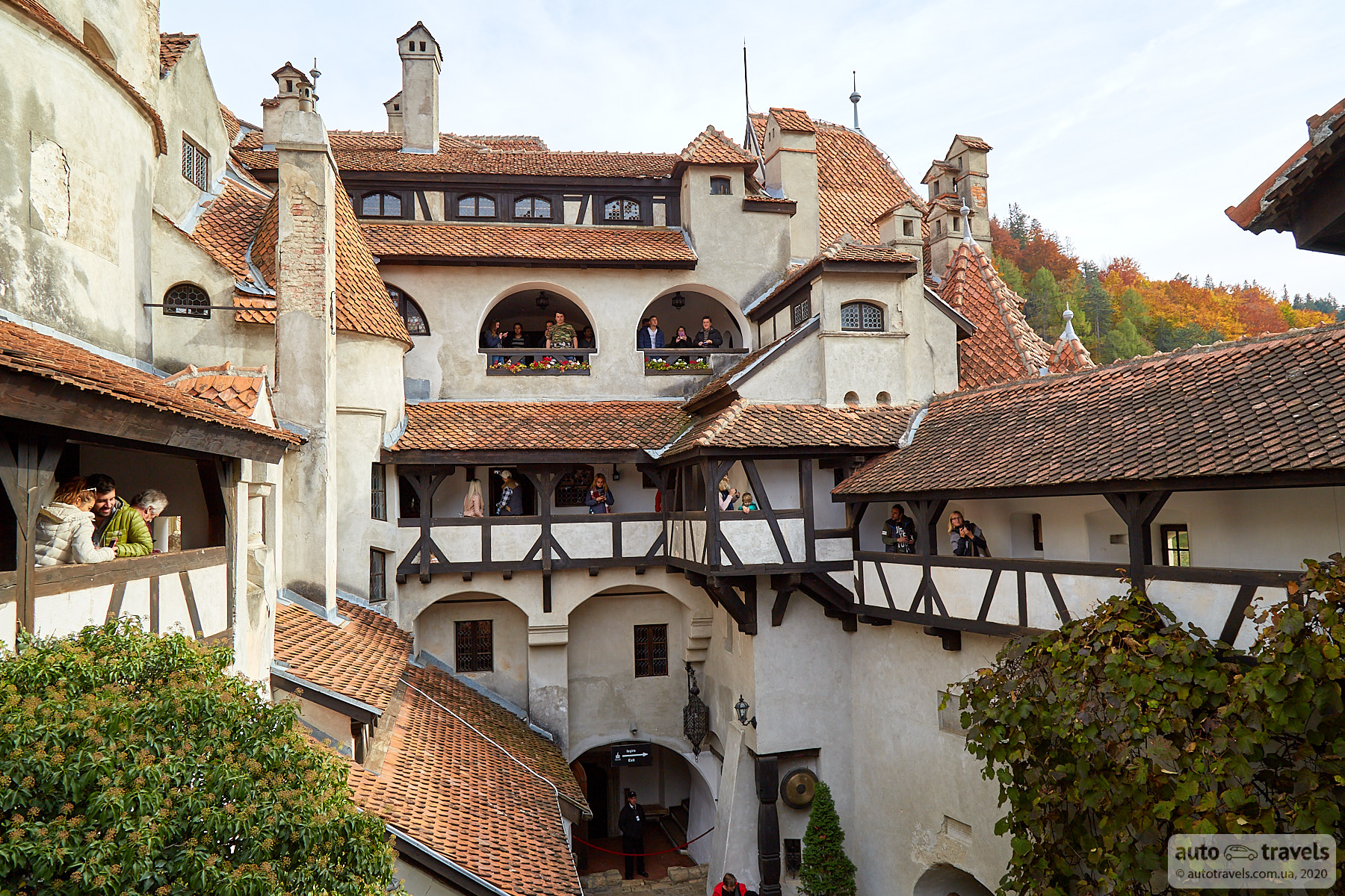
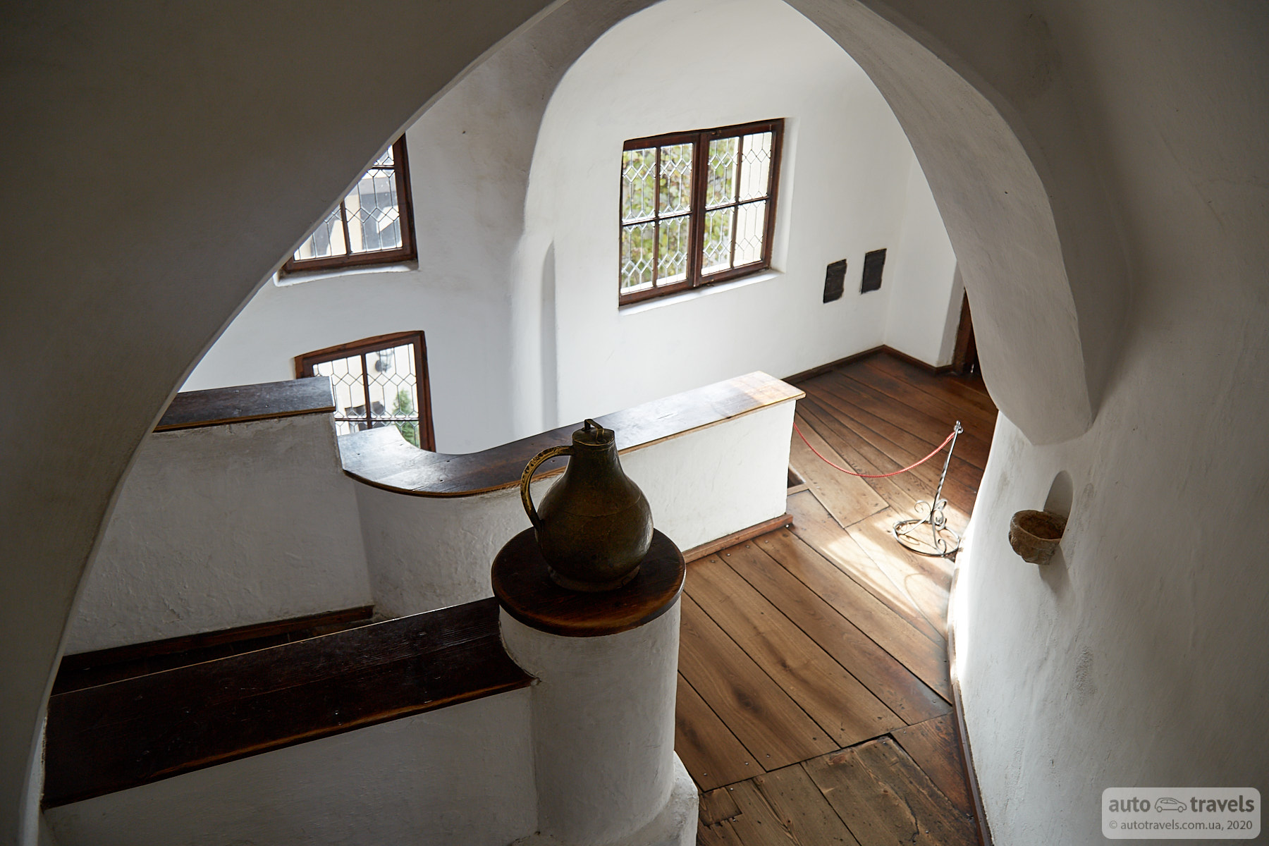
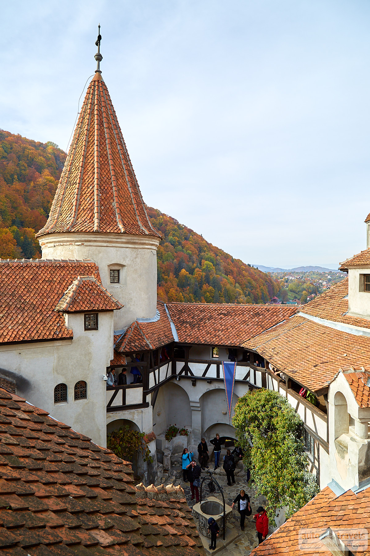
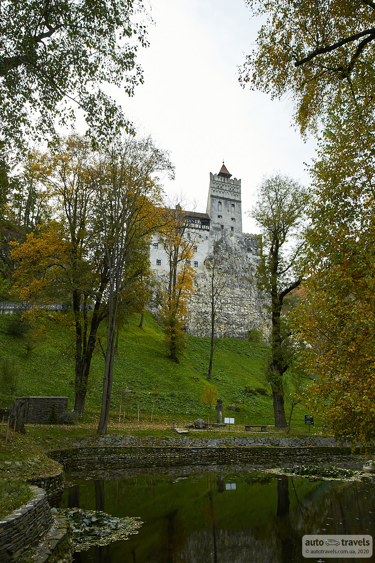
Bran Castle (Dracula's Castle) – Castelul Bran
Coordinates on Google Maps: https://goo.gl/maps/xpWhpVrXLp7mC7ZUA
Official website: http://www.bran-castle.com/
The castle in Bran is famously known as Dracula's Castle, and it's the most touristy spot on the route. The interior of the castle is not particularly interesting, just rooms with a large flow of people; you move constantly in queues, and if you stop, you'll be pushed from behind, not enjoyable at all. The only things worth attention are the upper terrace and the castle courtyard; these areas are genuinely beautiful. It's also nice to walk around the castle's surroundings, maybe even walk around the castle from the road after exiting its territory for a different perspective. The entrance to the castle's territory is near Primăria Bran (Bran Town Hall).

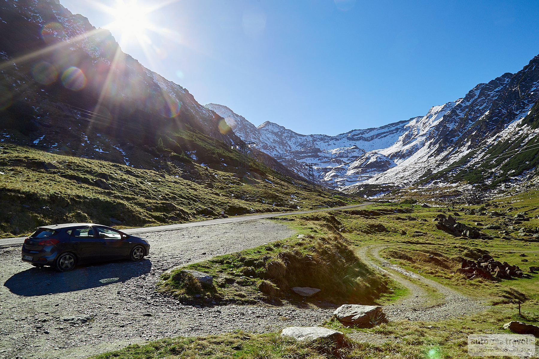
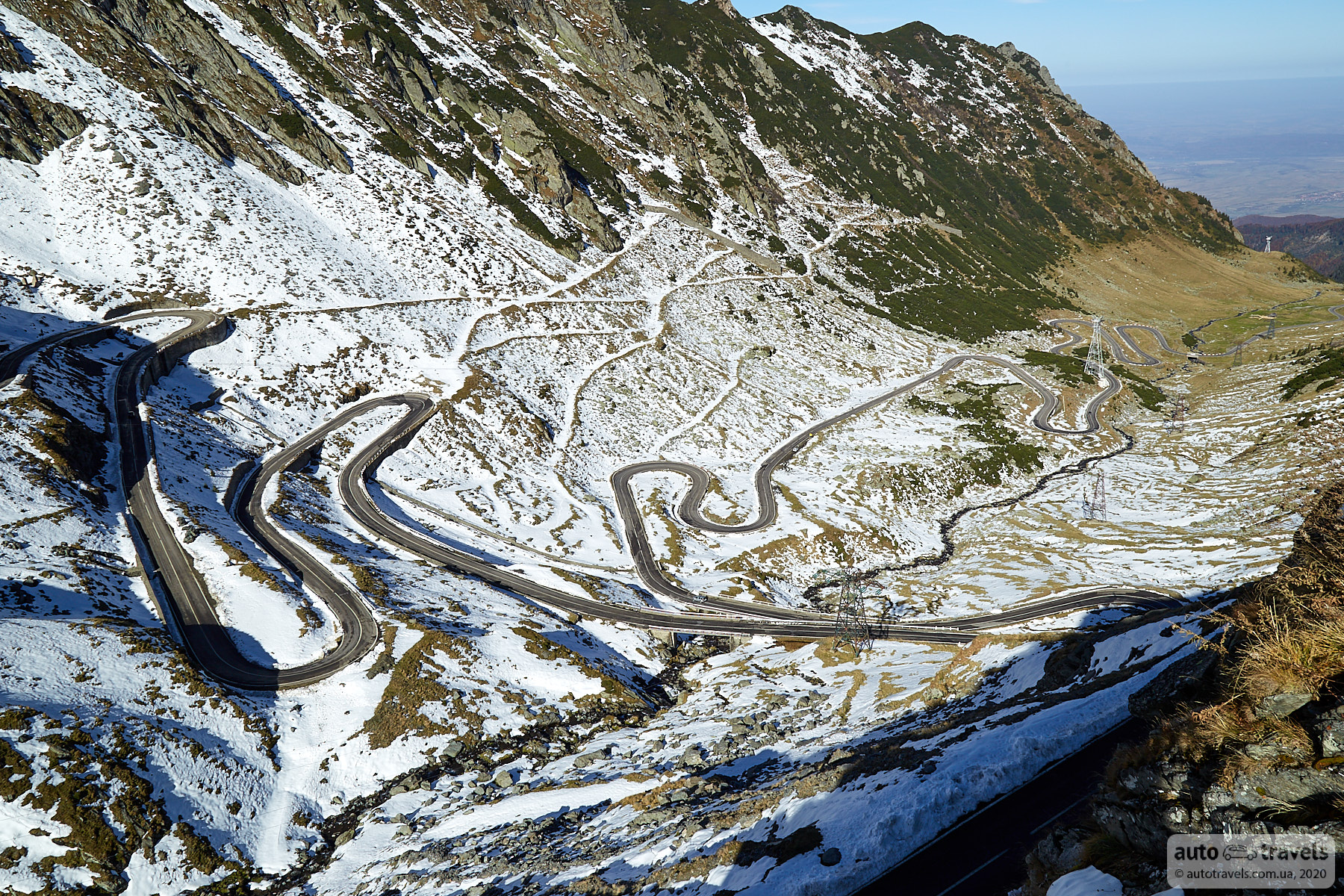
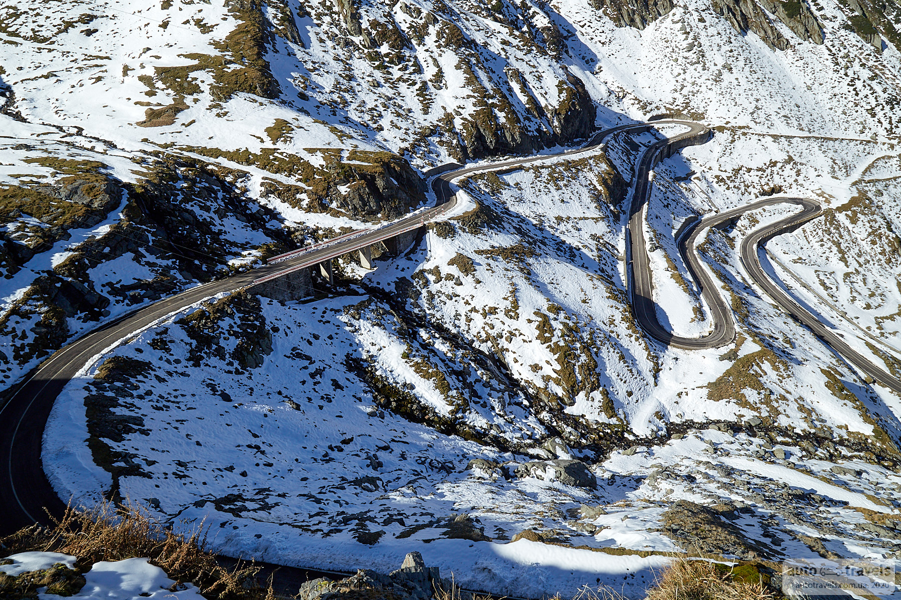
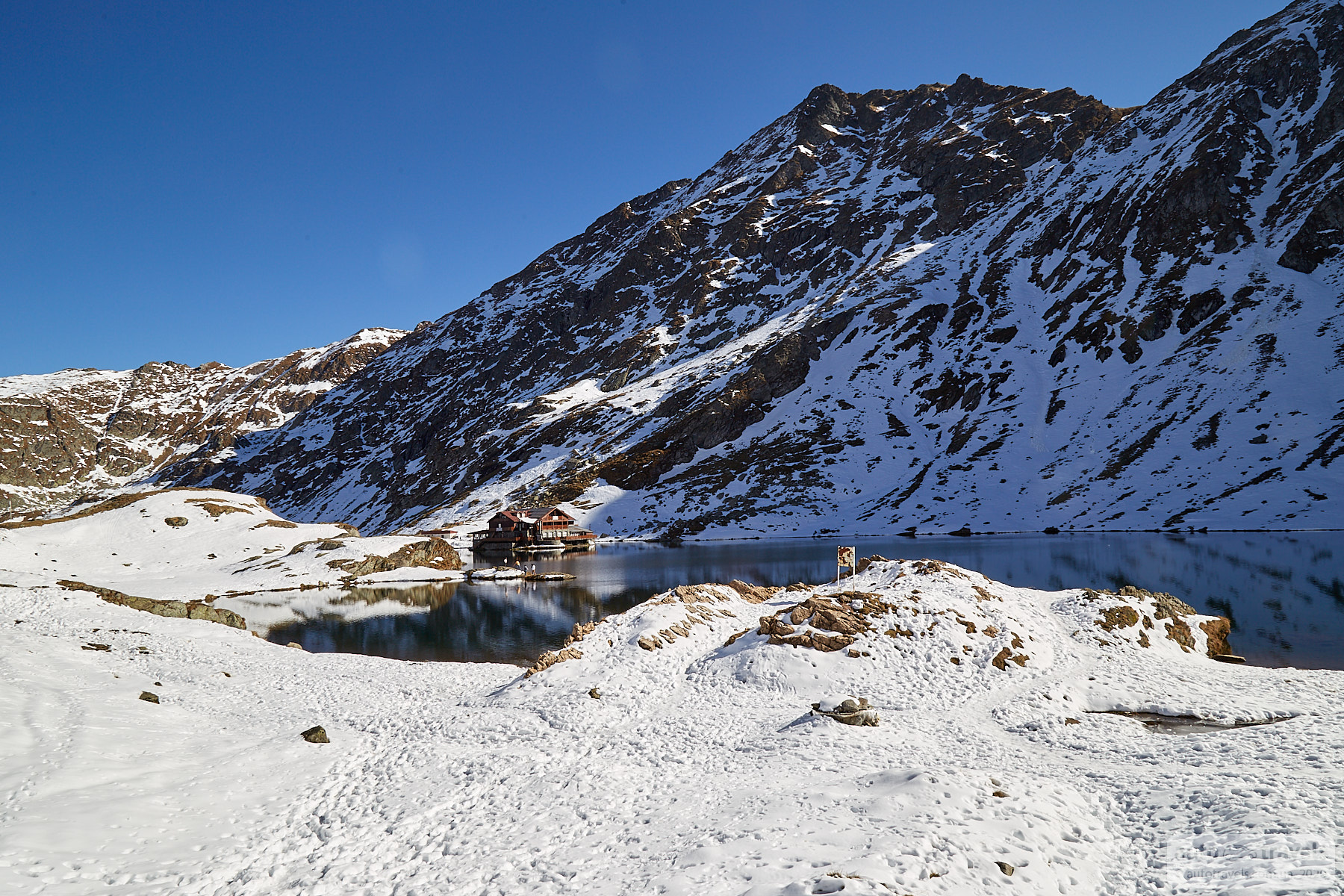
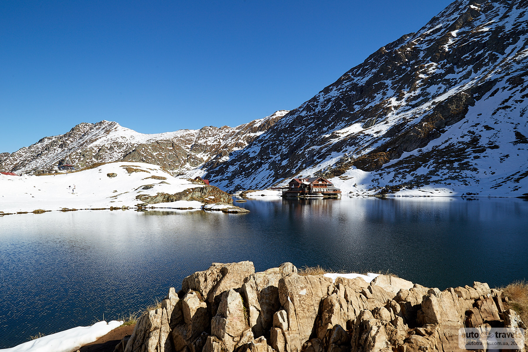
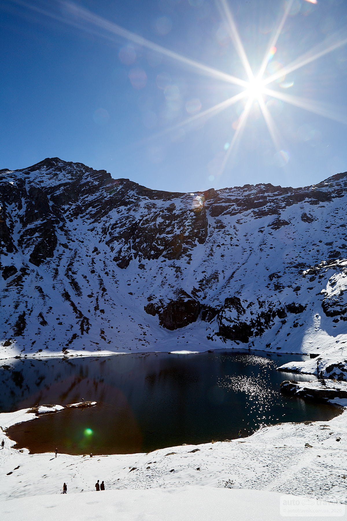
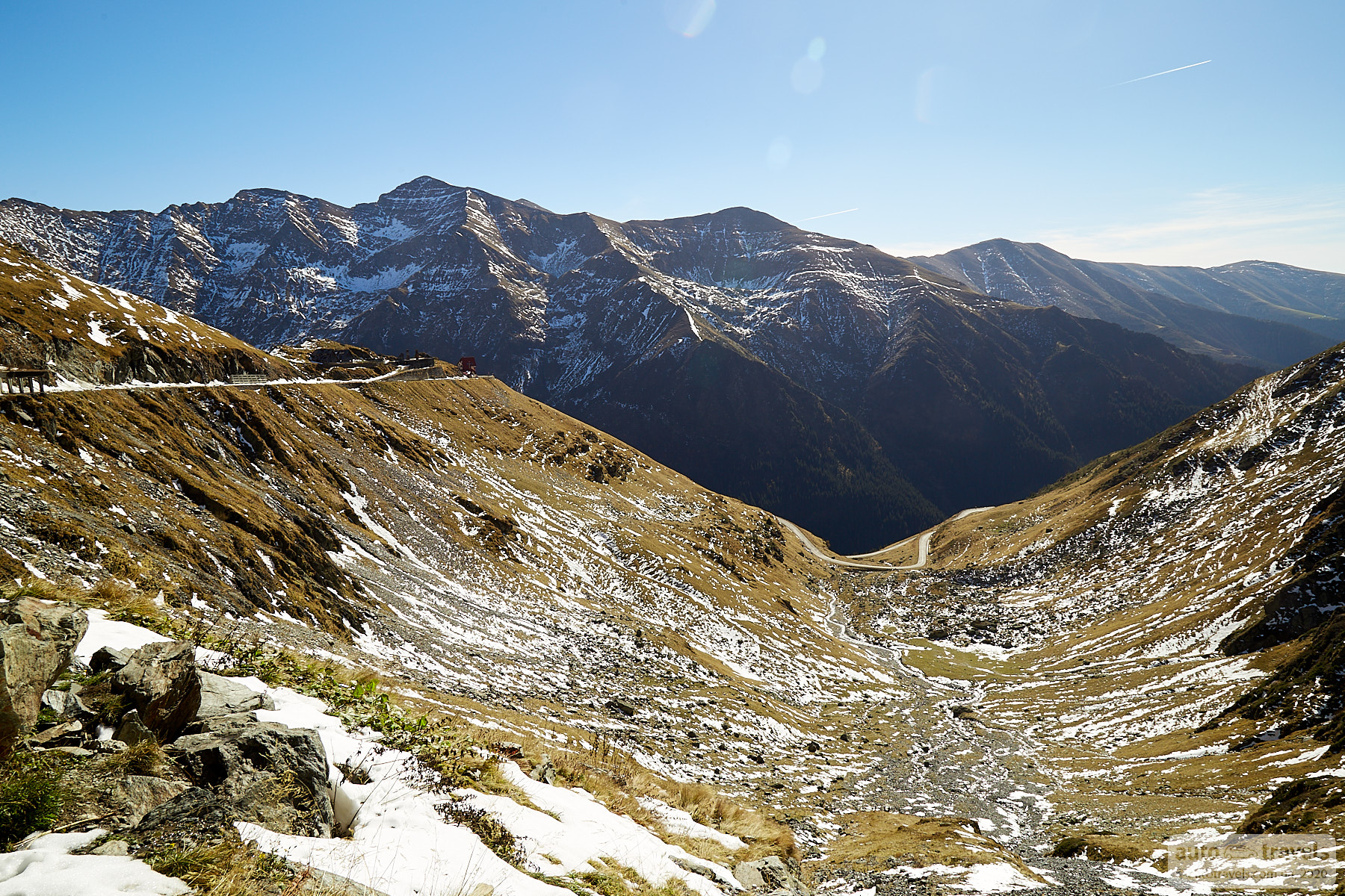
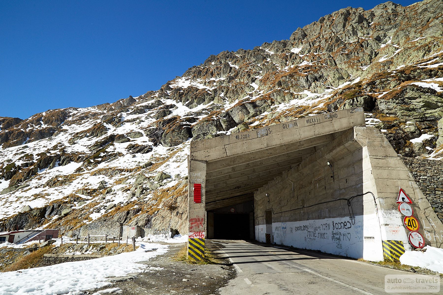
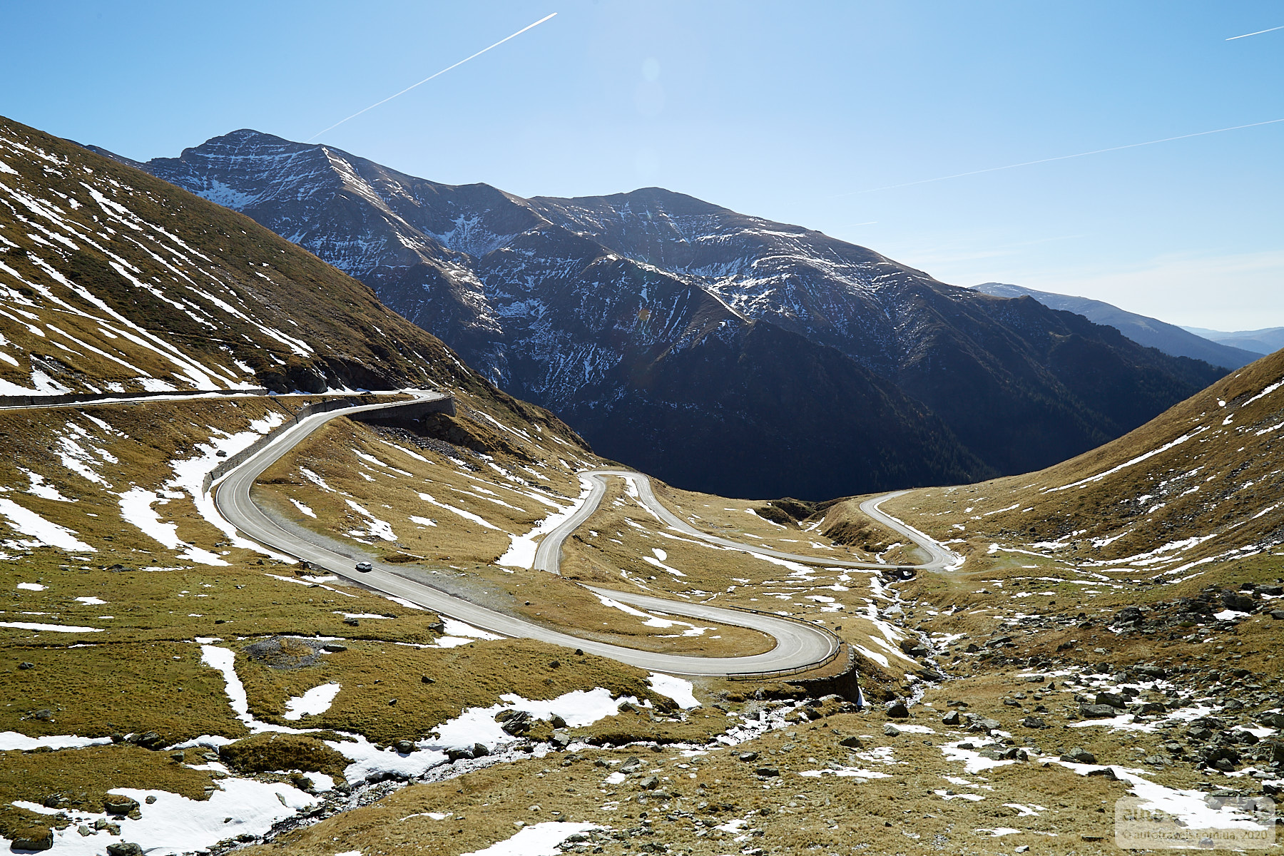
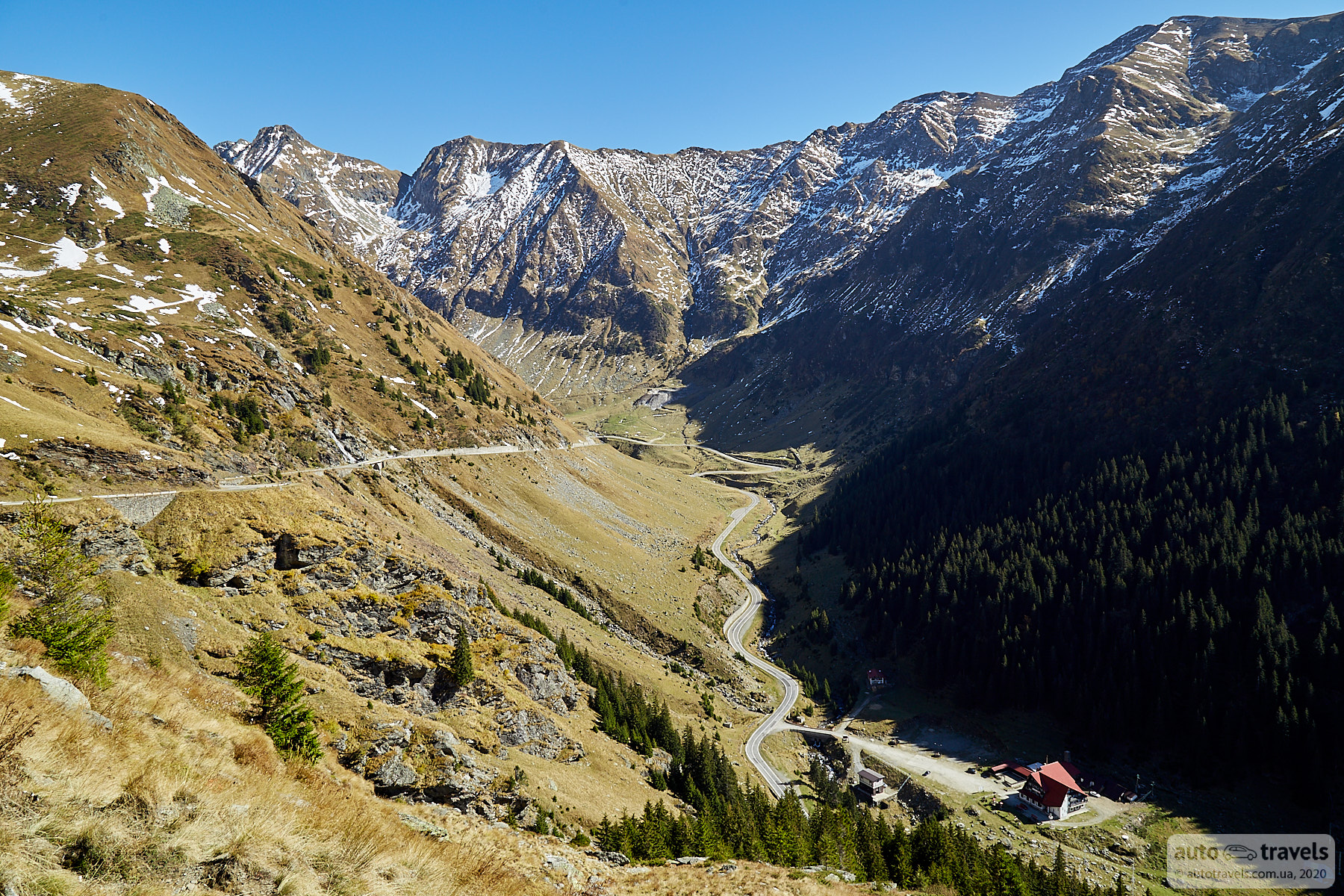
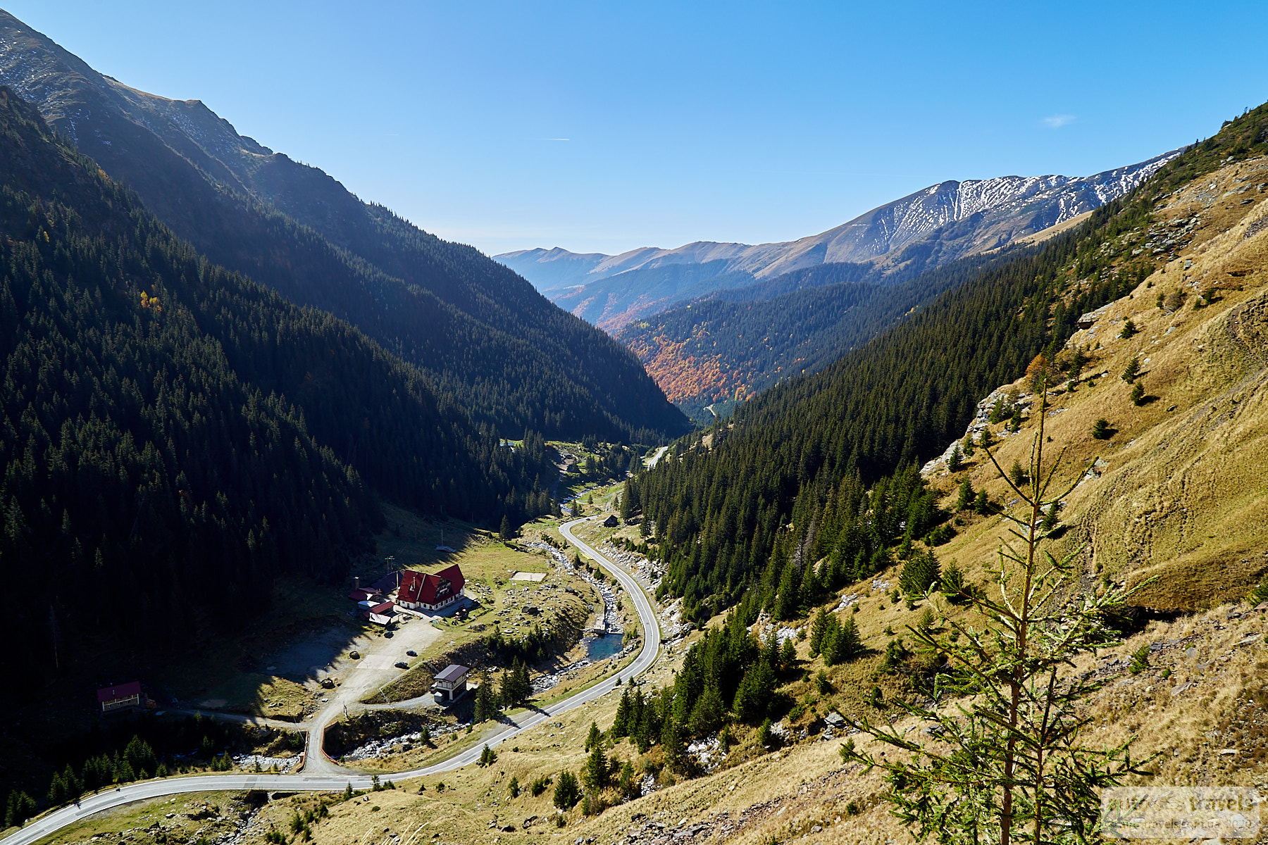
Transfăgărășan

7c is the number of the Transfăgărășan road, as indicated on maps and road signs. Transfăgărășan is a road across a mountain pass with picturesque views. Such roads are commonly referred to as scenic routes.
Coordinates on Google Maps: https://g.page/transfagarasan-ro?share
Official website: https://www.transfagarasan.net/
Official Facebook page: https://www.facebook.com/Transfagarasan
This is an incredibly beautiful road. One of the episodes of the Top Gear show was filmed here. We entered from the south in the evening. A picturesque lake with a huge concrete dam is a stunning sight, showcasing both nature and human craftsmanship. Then, a winding road up the mountain. We reached the pass around 9 PM and saw a sign about the nighttime travel ban, but staying there was not an option. Therefore, we had to drive down, breaking the rules.
The next day, we returned to drive the road during daylight. From a route planning perspective, this was a big mistake. During the day, the road is simply captivating. Scenic views, bridges, tunnels, concrete canopies above the road. The real fun begins when you need to overtake some clunker crawling ahead on the narrow road, but there are places for passing. The principle of movement is simple: drive, find a nice spot, stop. Usually, at all beautiful places, there is space to pull over on the side. The road is scenic, so there isn't much traffic. At the very top, there's a large parking lot and a nearby lake. It's worth stopping here for about 20 minutes.


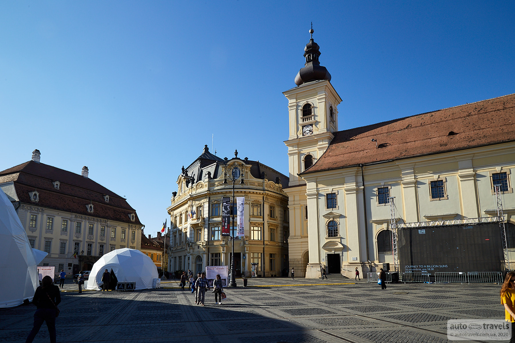
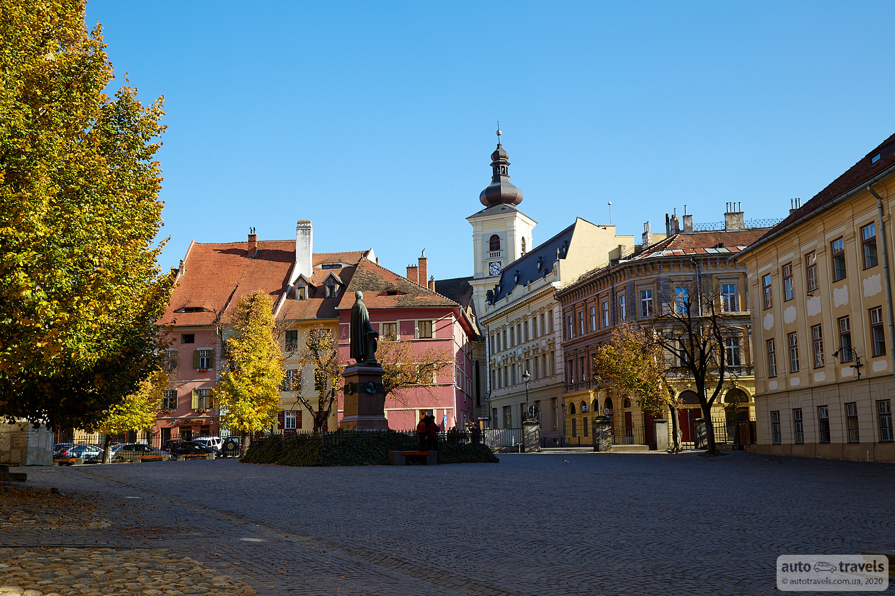
Sibiu
A charming, peaceful Romanian town. A good place to stay overnight.


Corvin Castle – Castelul Corvinilor
Google Maps Coordinates: https://g.page/castelulcorvinilor?share
The castle is slightly off the route, but it's very beautiful and worth a visit. If you find the castle closed, you can go around it from the left and, by climbing over a small fence, get closer. This is how the photos below were taken :) Here's the location to climb over the fence: https://goo.gl/maps/yVL3e4EoiqiLhnSGA


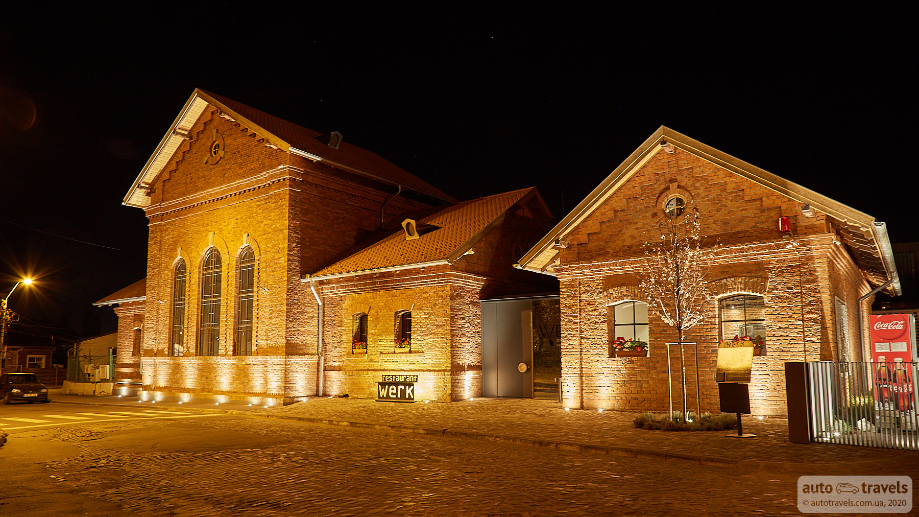
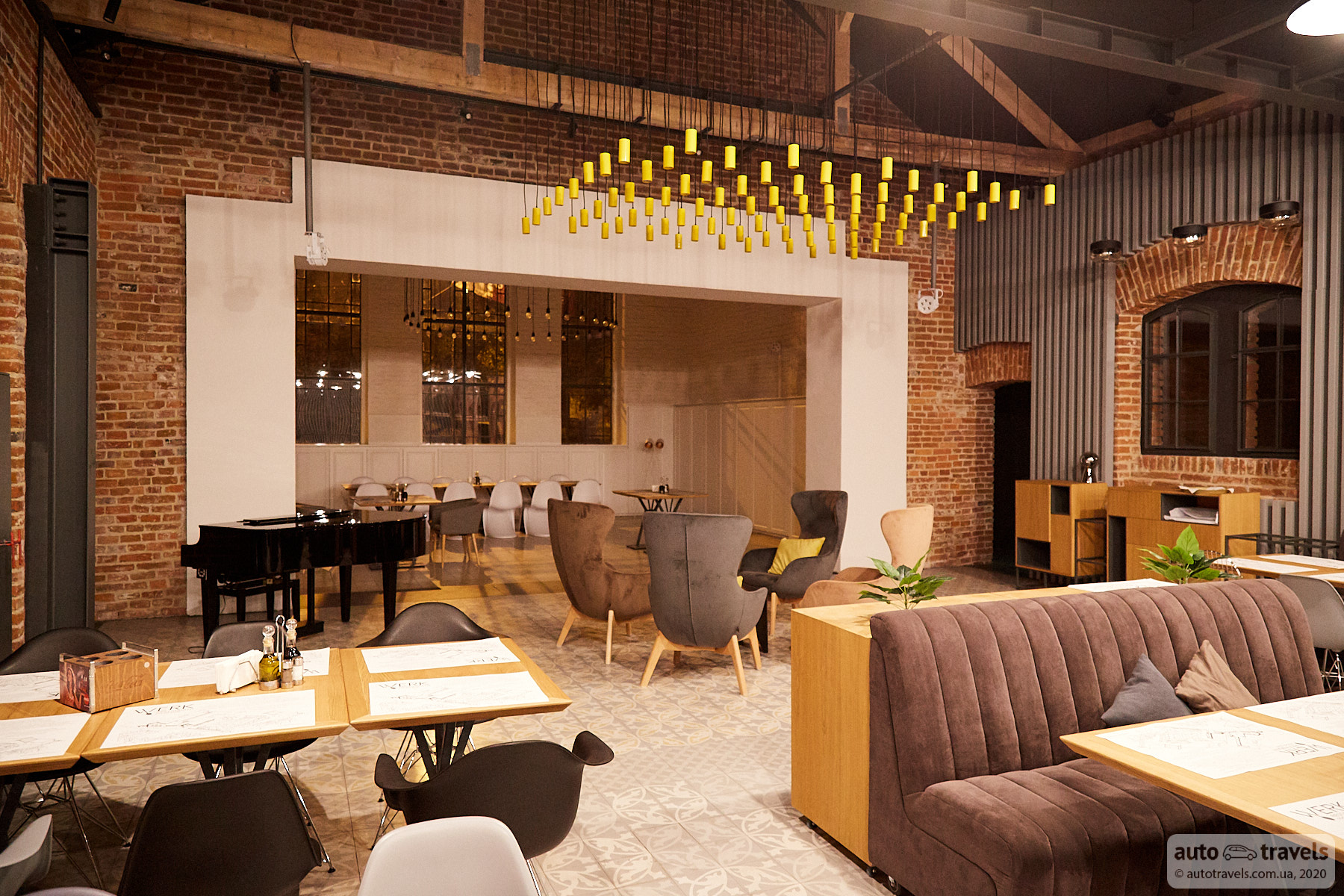
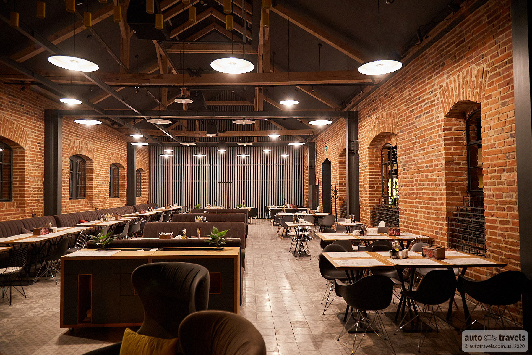
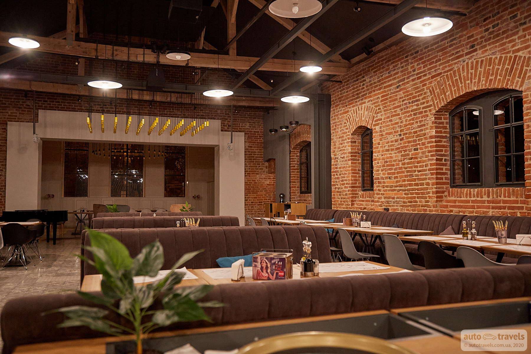
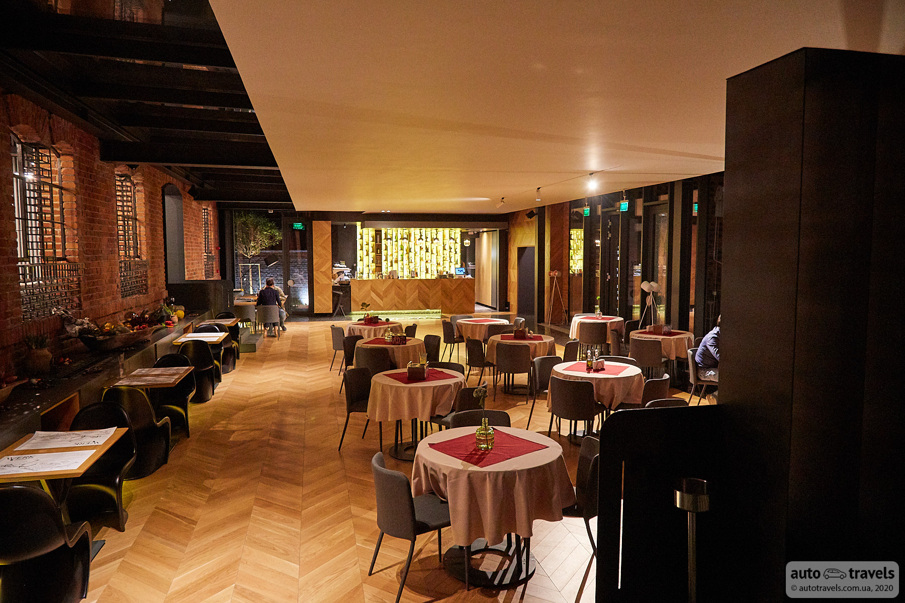
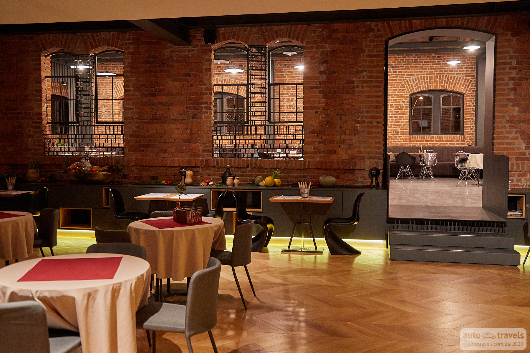
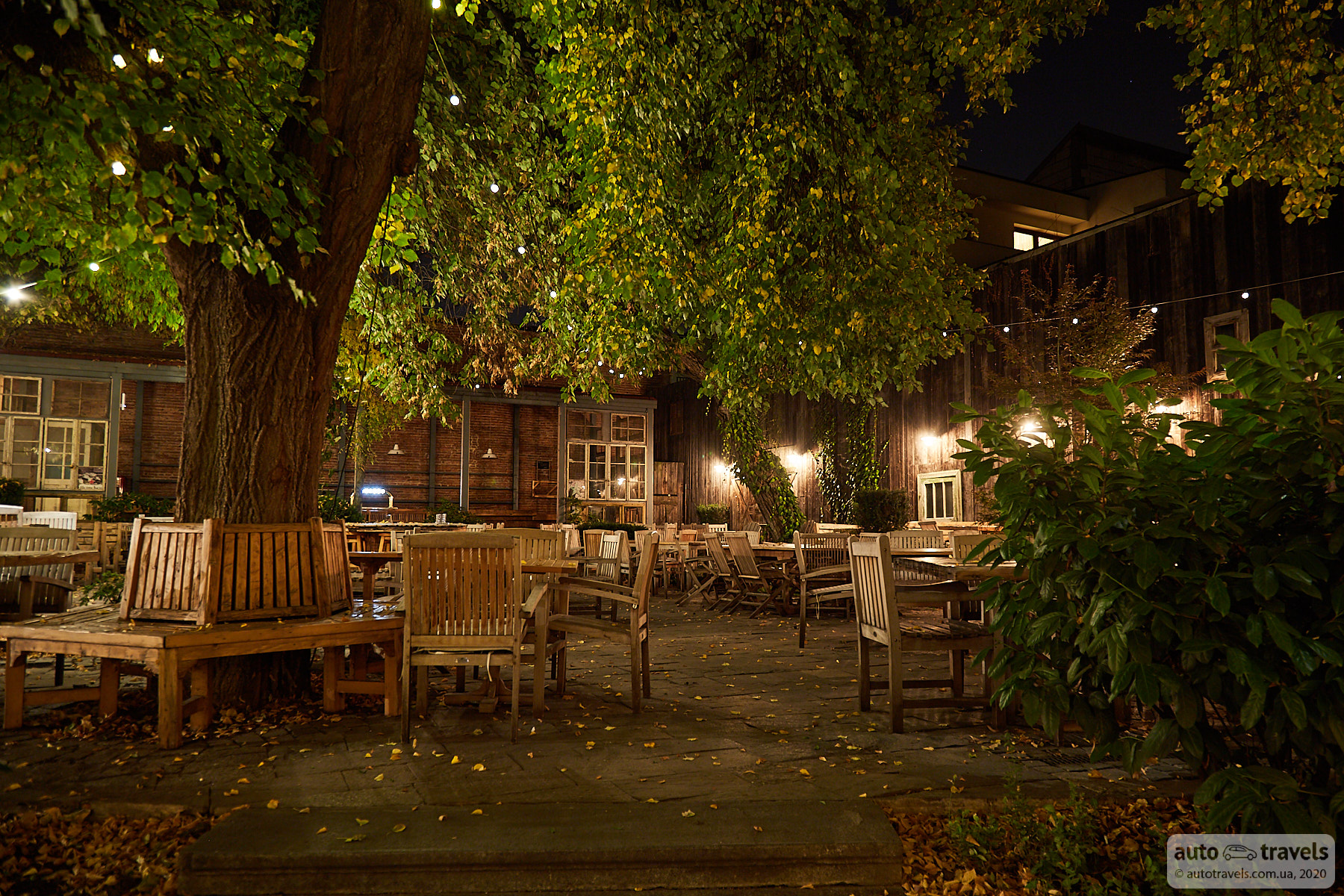
WERK Restaurant
Google Maps Coordinates: https://goo.gl/maps/bAxKVApmTT8FbkB66
If you love loft spaces, WERK is a restaurant worth checking out. You don't necessarily have to order anything; you can just take a stroll and enjoy the ambiance.
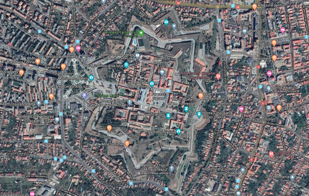
Alba Iulia Citadel – Cetatea Bastionară Alba Carolina
Google Maps Coordinates: https://goo.gl/maps/sqPoFRjns4YsUwQh7
If you manage to visit this citadel, please share your impressions. Unfortunately, we didn't have time to stop by.
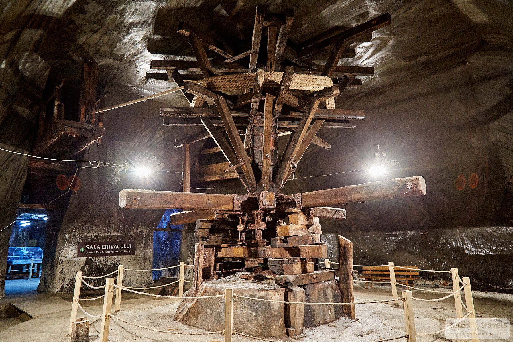
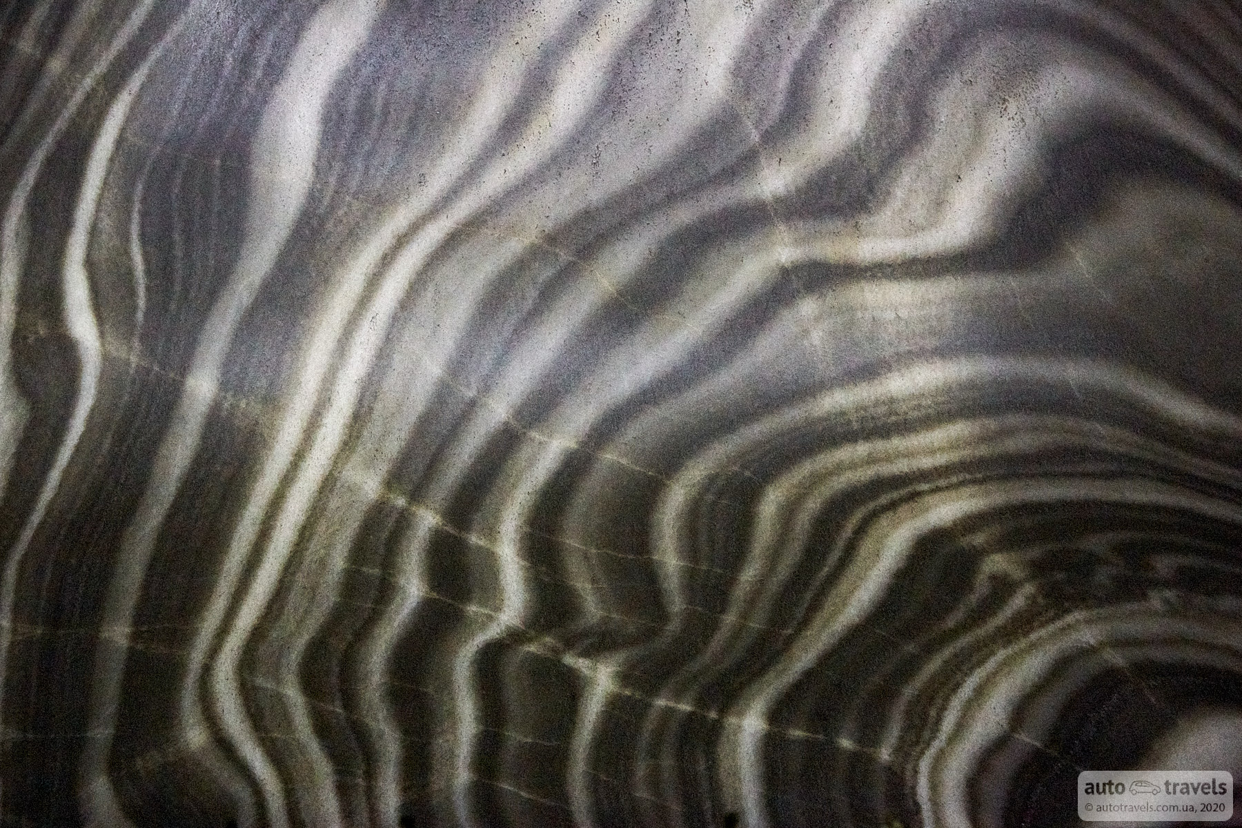
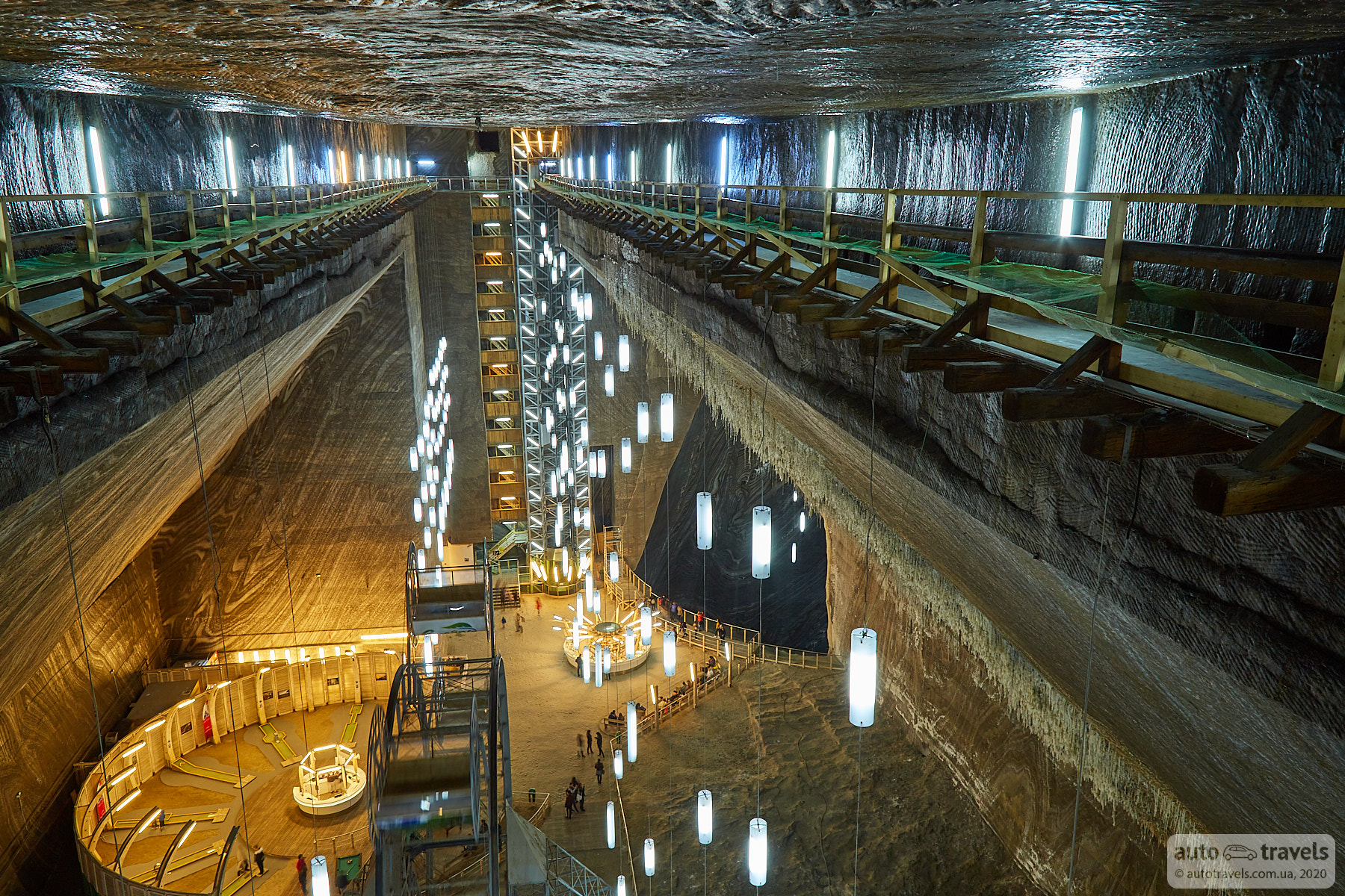
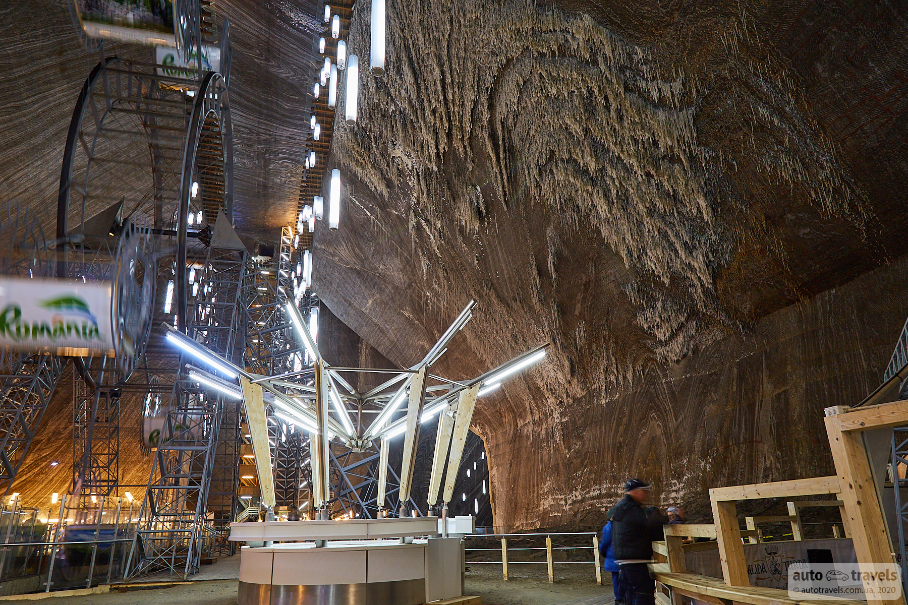
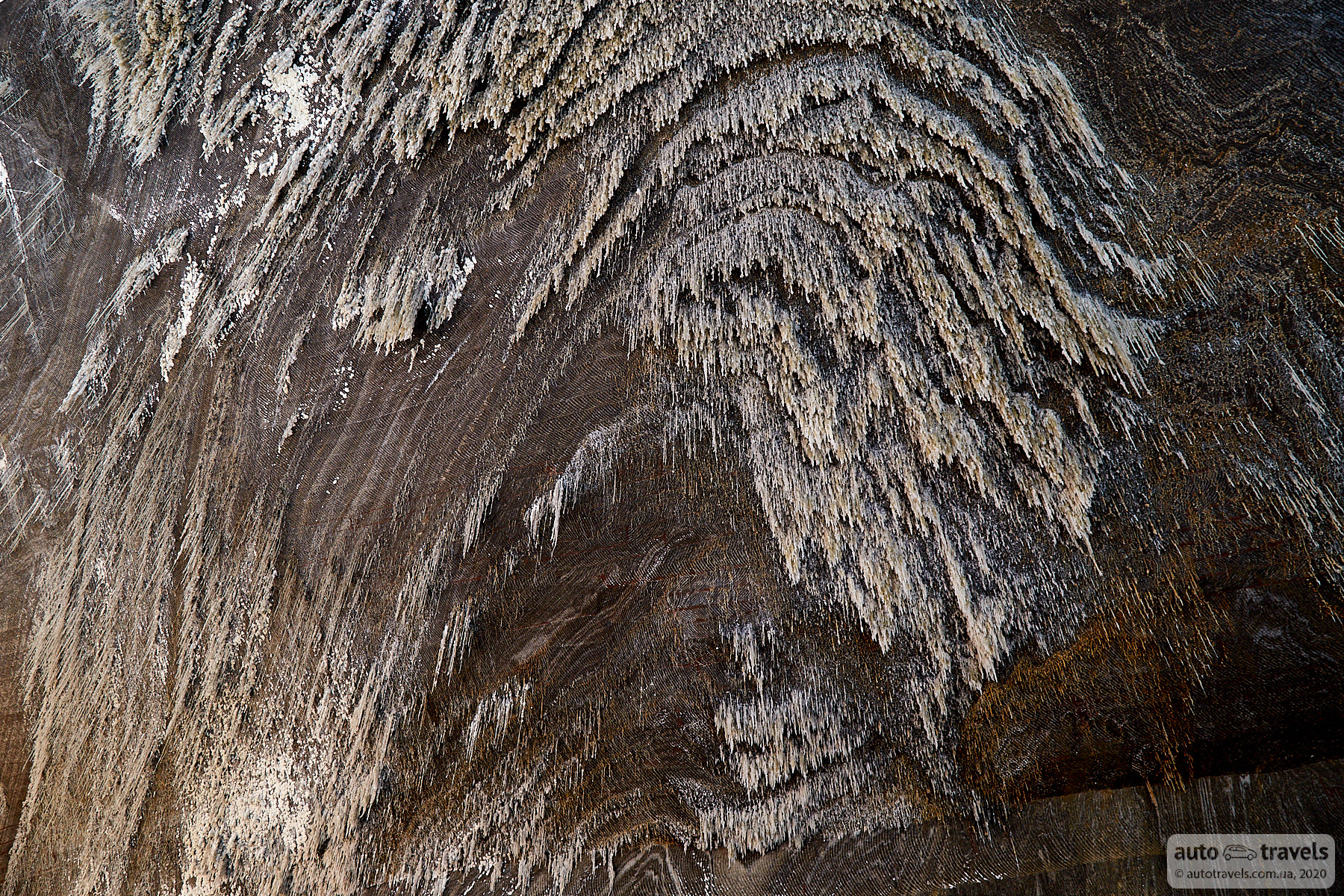
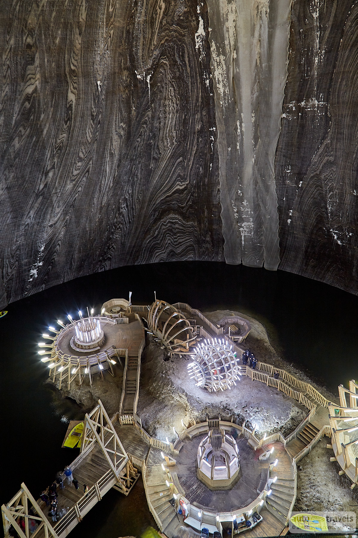
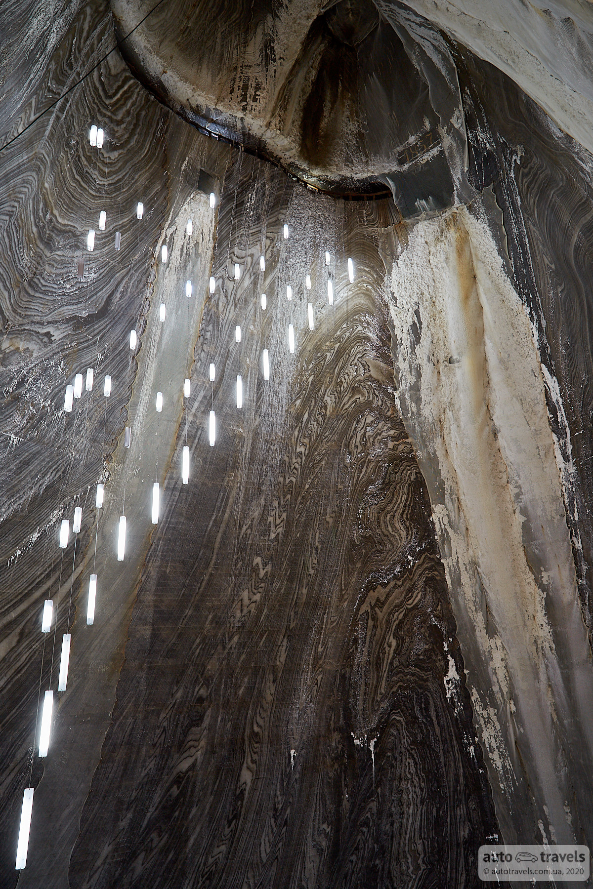
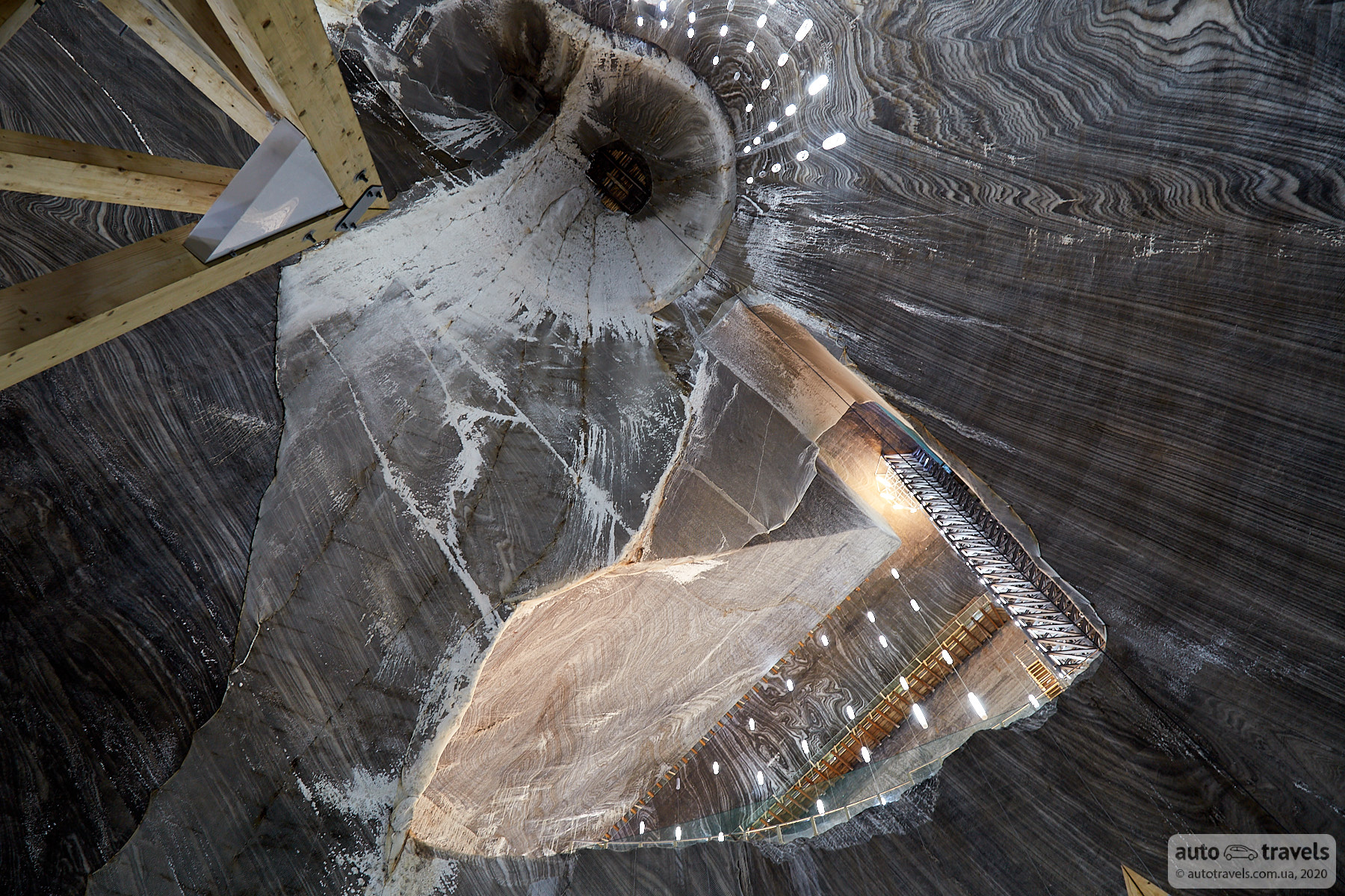
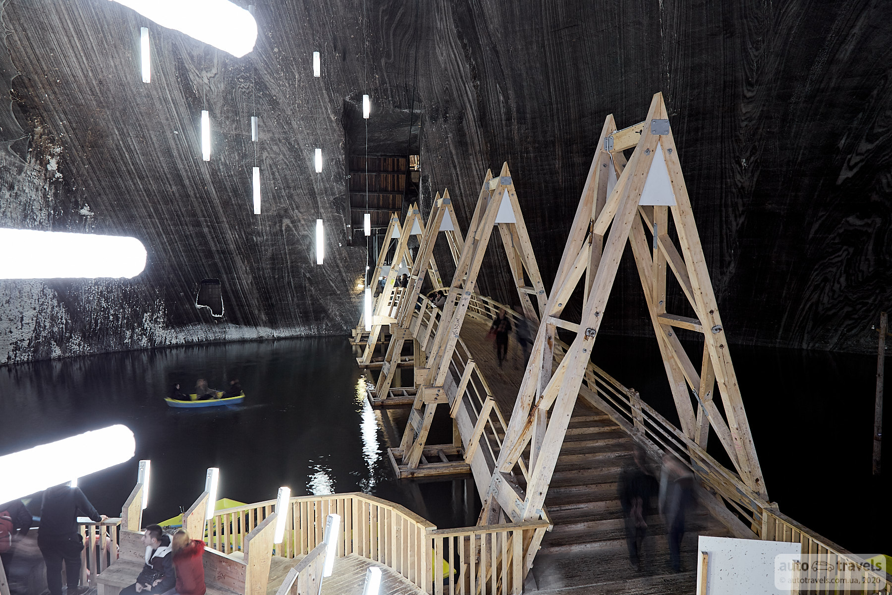
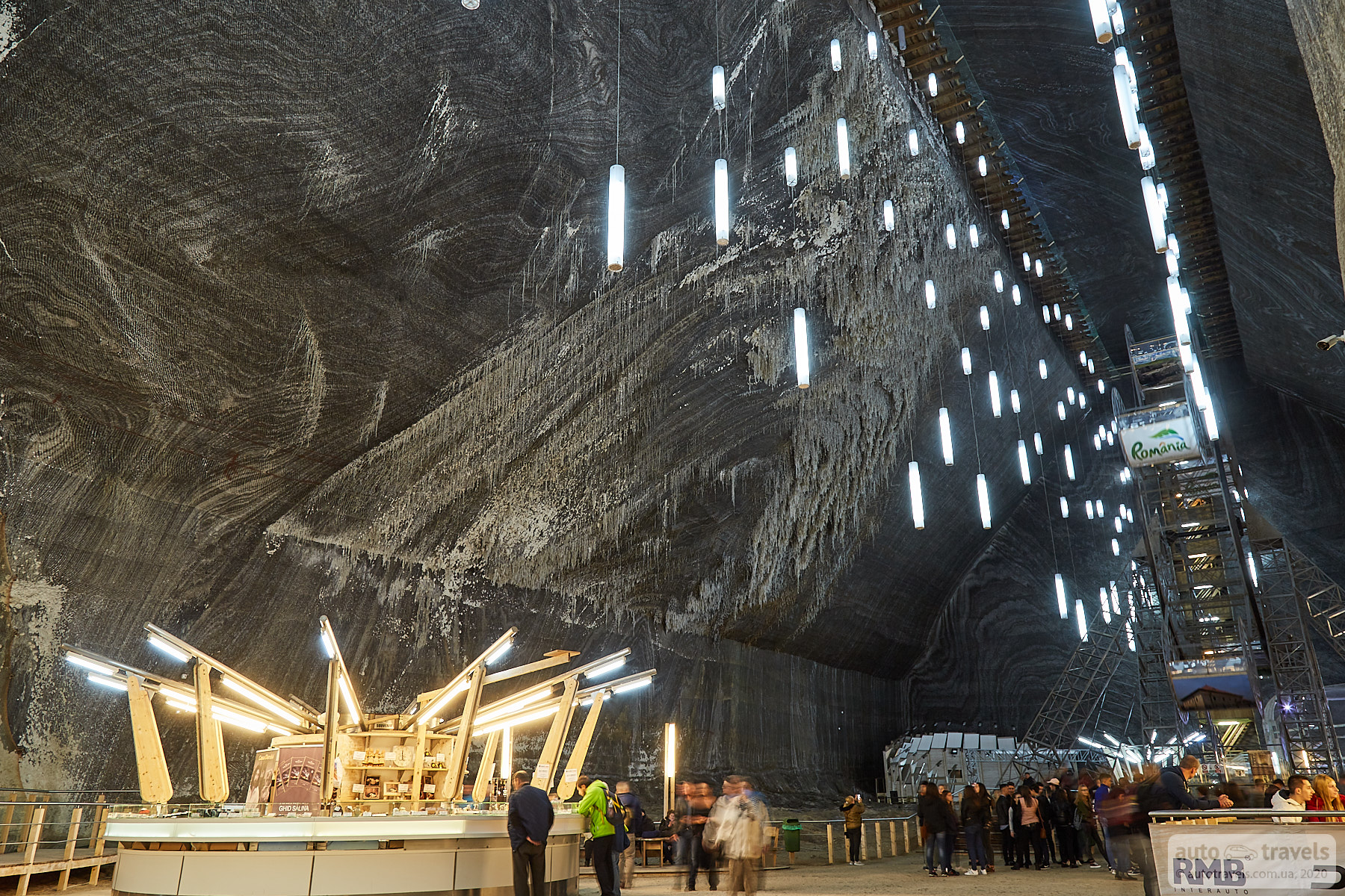
Turda Salt Mine – Salina Turda
Google Maps Coordinates: https://goo.gl/maps/SRPeXwxMdZ32E3xw5
Official Website: https://salinaturda.eu/?page_id=648&lang=en
Turda is an example of how a former salt mine can be turned into an entertainment center. Similar places exist in Poland, near Krakow in Wieliczka. In Turda, there's an observation wheel inside the mine, mini-golf, various games and attractions, and boats on an underground lake. It's recommended to descend into the mine on foot and use the elevator for the ascent. I highly recommend a visit; I haven't encountered anything similar before my trip to Romania.


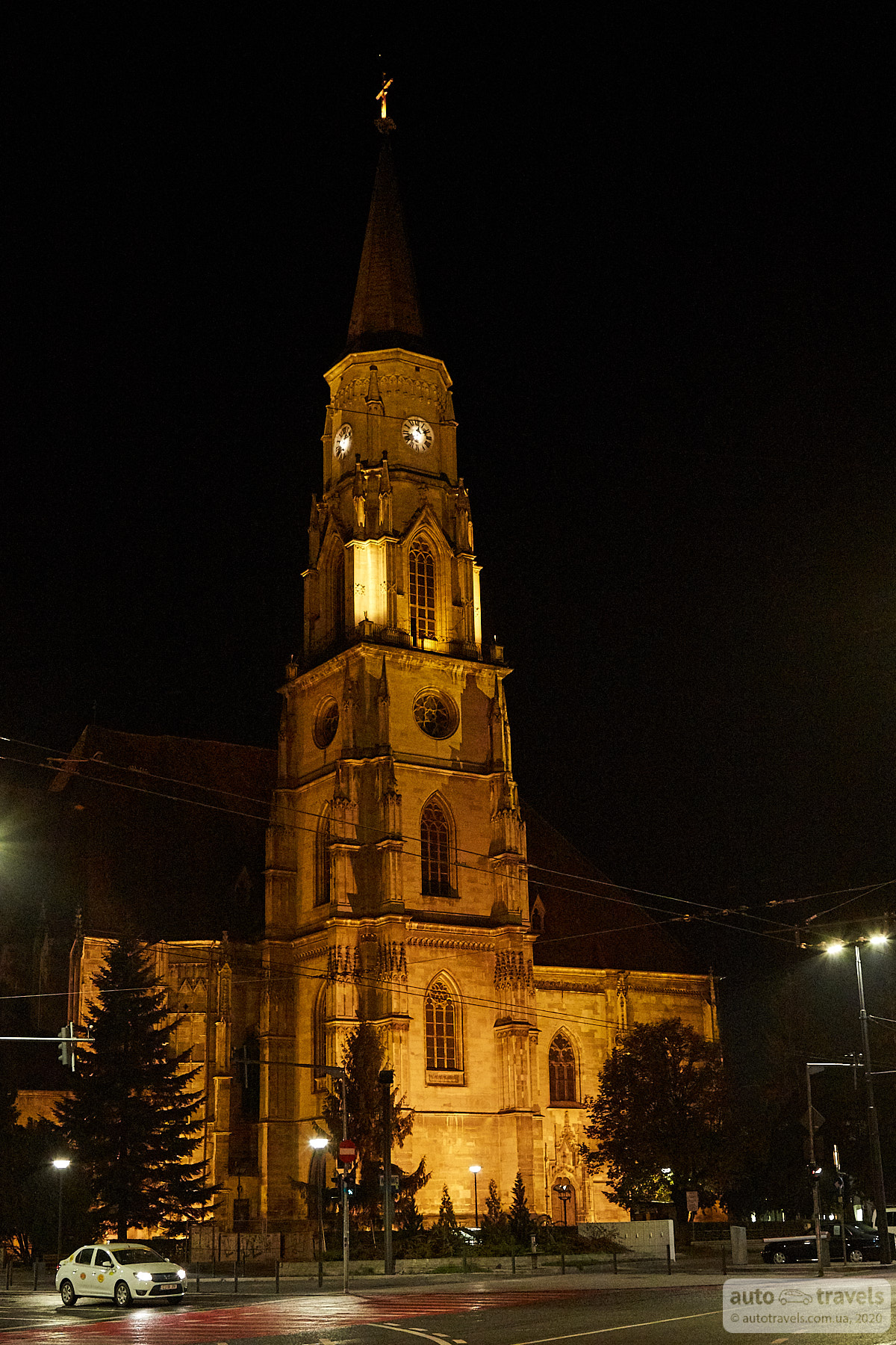
Cluj-Napoca
The largest city on the route. We were only in the city at night, and an evening stroll was enough to understand that spending time in the city wasn't very appealing. It didn't seem particularly special. Maybe I'll explore the city when I depart from Cluj-Napoca International Airport. There are many affordable flights from this airport with WizzAir.
You can now head back to the border.
If we consider how we traveled this route, we didn't do it optimally. We missed the forest railway, which is best visited in the morning before exploring other points of interest. In Bran, we went to Dracula's Castle, which took about 40 minutes and wasn't worth it. We didn't have time for the Transfagarasan during the day, so we drove it in the evening, stayed in Sibiu, and returned to the pass. We visited Turda, stayed overnight in Cluj-Napoca, and returned to the mine in the morning.
Decide where you want to go and plan your trip more carefully. This part of Romania will surprise you. We barely managed to see everything in 4 days, and one more day would have been definitely helpful.